0315L-WEDNESDAY OUTLOOK FROM GARFIELD COUNTY EMERGENCY MANAGEMENT-9/13/23
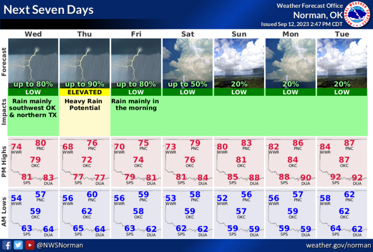
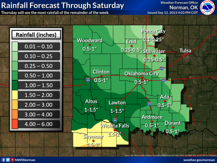
*Enjoy the cooler weather for the next several days. We will be gradually warming up and should be back in the mid to upper 80s by Tuesday. Sunday looks to be the beginning of 80s temperatures. Rain chances will be highest for us Thursday into early Friday. We’ll wait and see what happens for sure. Severe weather for us looks low right now. Many variables involved so just enjoy the cooler weather and the gradual warmup.
*Overall, we’ll be ok and cool so enjoy. Here is your forecast from the NWS/NORMAN;
Wednesday- Mostly sunny. Highs in the upper 70s. East winds around 5 mph.
Wednesday Night- Partly cloudy with isolated showers in the evening, then mostly cloudy with scattered showers after midnight. Lows around 60. East winds around 5 mph. Chance of rain 40 percent.
Finally, Winter is just around the corner, so to speak, so look around the house, look around at work to see what needs to be done to keep the warm air in and the cold air out. It isn’t difficult to prepare but dollars can be saved by doing a little here and there to seal off those leaks. It’s your money!
HAVE A GOOD DAY!