0340L-WEDNESDAY OUTLOOK FROM GARFIELD COUNTY EMERGENCY MANAGEMENT-9/15/21
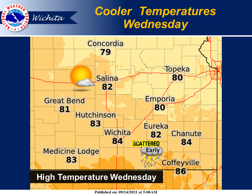
1- Thunderstorms are ongoing in south central Kansas this morning but are NOT severe. They are dumping a lot of rainfall and moving SSE about 10-20 mph. Per NWS Wichita Guidance, these storms “should” diminish just after sunrise and the front will wash out in central Kansas later today.
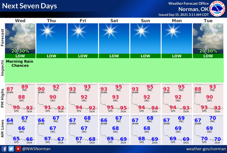
2- Norman Guidance this morning appears to be about the same as Wichita’s but leaving in a slight chance for showers. Sometimes, the models don’t cooperate. Other than this, we’ll be ok. Cooler temps may be on the way next week as a cold front MIGHT make it this far south really cooling things off. Looking forward to that!
3- Here is your forecast from the NWS/NORMAN;
Wednesday-Partly cloudy. A slight chance of showers and isolated thunderstorms in the morning. Highs in the upper 80s. Southeast winds around 10 mph. Chance of precipitation 20 percent.
Wednesday Night-Clear. Lows in the mid-60s. Southeast winds around 10 mph in the evening becoming light and variable.
FINALLY, I will be posting a link on social media and on our GARFIELD COUNTY EM app Blog later today to a document that I wrote on PREPAREDNESS. This link will take you to our gcem.org website “DOCS” page. This should help some folks actually take the time to get prepared just in case we do have severe ice storms or even tornadic storms this winter THAT DISRUPT UTILITIES and what procedures we have to follow, and what YOU NEED TO DO. There actually is more on you to do than there is for us in government.
STAY SAFE
MIKE