0305L-WEDNESDAY OUTLOOK FROM GARFIELD COUNTY EMERGENCY MANAGEMENT-9/27/23
* The WSR-88D weather radar at Kegelman Field known as KVNX is still down. Return to service is undetermined.
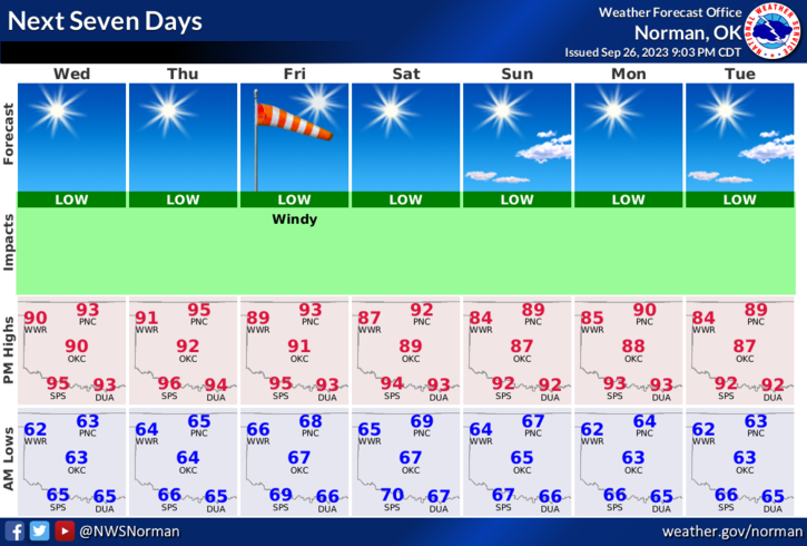
* Warm temps will continue well into next week and the winds will increase later on Thursday through the weekend with some wind gusts upwards of 30 mph. High temps will average around 90 or higher with overnight lows in the 60’s. No rain is expected.
* The FIRE DANGER is creeping upwards now. Per the US Drought Monitor, Garfield County is in a NO drought, Abnormally Dry, and Severe Drought area. My personal opinion on this is that the whole county should be in a severe drought situation. Either way, Dewpoint Temps will average in the 50s and relative Humidity will average in the 30s during the day. If you see smoke or fire, call 9-1-1. If anyone decides to do a controlled burn, call dispatch at 580-234-3473 and let them know. They’ll let us know.
Overall, we’ll be ok so enjoy the nice fall heat. Here is your forecast from the NWS/NORMAN;
Today- Sunny. Highs in the lower 90s. South winds 5 to 10 mph.
Tonight- Clear. Lows in the mid-60s. South winds 5 to 10 mph.
HAVE A GOOD DAY!