0315L-THURSDAY OUTLOOK FROM GARFIELD COUNTY EMERGENCY MANAGEMENT 04/25/24
*READ CAREFULLY: Today’s information will point you towards graphics. These graphics will change throughout the day and will change through the weekend. I will only post graphics here for TODAY ONLY but go to the NWS/NORMAN website to see all of them. Again, they will change over time. https://www.weather.gov/oun/
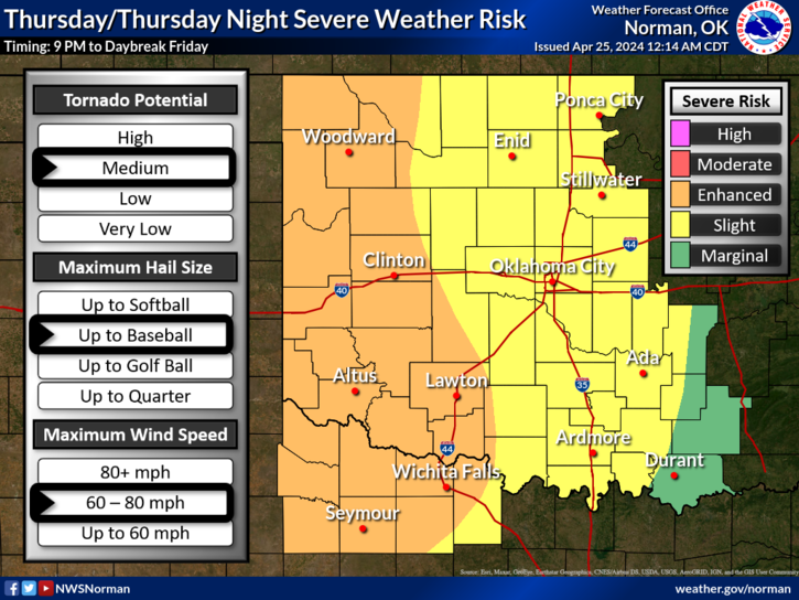
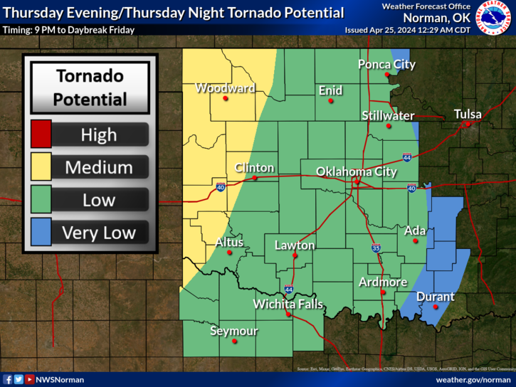
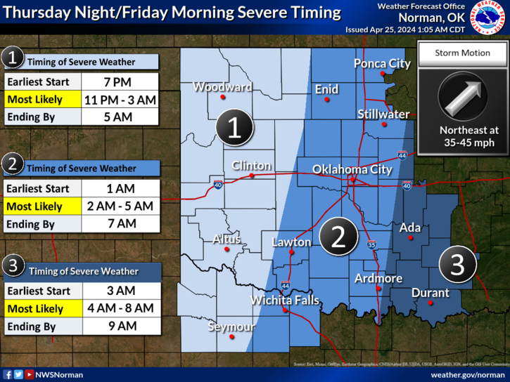
*Slight risk for severe weather today, here- see graphic 1. ALL HAZARDS are possible WHEREVER supercell storms form which will most likely occur out west in the Enhanced area. The Tornado potential is low but again they will be associated with supercell storms along with very large hail, see graphic 2. TIMING- appears to be later tonight through the overnight hours and storms will move Northeast at 35-40 mph, See graphic 3.
*All of the above stated, if you plan on traveling, pay very close attention to the forecasts in those areas. The graphics on the NWS website for Friday and Saturday will change depending on what happens the night before so don’t get too fixated on those graphics BUT keep them in mind. SATURDAY may be the higher risk for our area for severe weather but we’ll wait and see what happens tonight and tomorrow.
*Overall, we’ll be ok so don’t let the TV Media scare you to death. Be sure you have a plan in mind and just be ready to implement that, just in case. Here is your forecast from the NWS/NORMAN;
Today- Cloudy with a chance of thunderstorms. Showers likely, mainly this morning. Some thunderstorms may be severe. Highs in the mid-70s. South winds 15 to 20 mph with gusts up to 30 mph. Chance of rain 70 percent.
Tonight-Thunderstorms likely, mainly in the evening. Some thunderstorms may be severe. Lows in the lower 60s. South winds 15 to 20 mph with gusts up to 35 mph. Chance of rain 90 percent.
NO NEED TO PANIC, JUST PLAN AND STAY INFORMED. YOU’LL BE OK.
HAVE A GOOD DAY!