0330L-WEDNESDAY OUTLOOK FROM GARFIELD COUNTY EMERGENCY MANAGEMENT 04/24/24
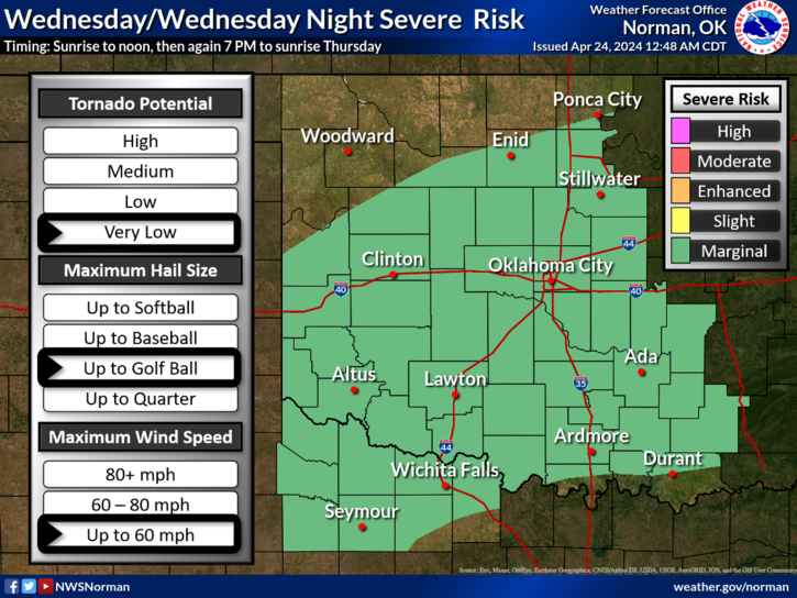
*MARGINAL RISK for thunderstorms starting as early as this morning. We have quite a bit of elevated instability that could lead to a few thunderstorms with a hail threat. We’ll have to wait and see where this mess forms up and then adjust.
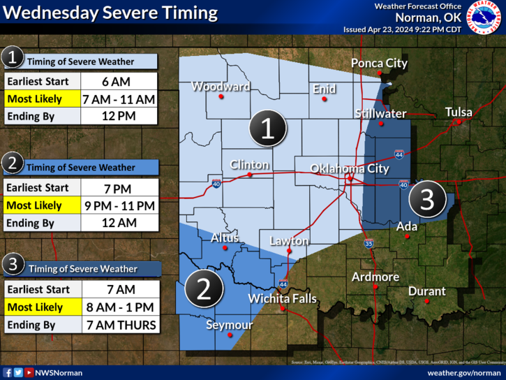
*Here is the web address for the NWS/NORMAN- https://www.weather.gov/oun/ Go here to see the graphics for the severe weather possibilities for the rest of the week. These graphics will change several times during the day so check them a few times as the days wear on. Don’t get fixated on where the lines are as they will change often.
*Starting Thursday, our tornado threat increases THROUGH Saturday. This is why I stress having a plan so IF you need to implement it, you’ll know what to do. Our chances are low but depending on where supercell storms track is where that threat may occur. Just make sure you have our GARFIELD COUNTY EM app and you’ll receive those notification from us and the NWS.
Overall, we’ll be ok, just stay weather aware. Here is your forecast from the NWS/NORMAN;
Today- Partly sunny with a chance of showers. A slight chance of thunderstorms this morning, then again, this afternoon. Highs around 70. East winds around 10 mph with gusts up to 20 mph. Chance of rain 50 percent.
Tonight- Cloudy with a chance of thunderstorms. A chance of showers in the evening, then showers after midnight. Lows in the mid-50s. East winds 5 to 10 mph. Chance of rain 80 percent.
NO NEED TO PANIC, JUST PLAN AND STAY INFORMED. YOU’LL BE OK.
HAVE A GOOD DAY!