0335L-TUESDAY OUTLOOK FROM GARFIELD COUNTY EMERGENCY MANAGEMENT 04/30/24
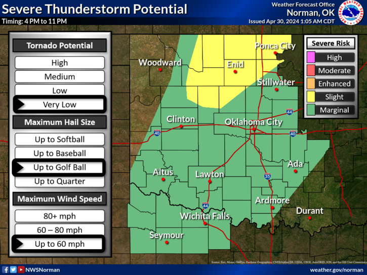
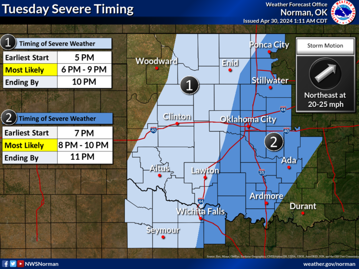
*SLIGHT RISK for severe weather later today. The dryline out west will slowly move east and a frontal boundary will be in the area coming in from the north. Moisture return will become very noticeable by early afternoon and instability will increase. The main threats for us will be golfball size hail, winds to roughly 60 mph, and a very low chance of additional tornadic activity. Most likely time for this to occur will be from 7 to 10 pm. REMEMBER, the graphics will change some during the day so I will update you all over the GARFIELD COUNTY EM app and on my EM page on facebook- @EGCEM
*We’ll be in a slight risk area pretty much all week so the chance for thunderstorms will be around. Those areas that received a lot of rainfall may see quite a bit more. The graphics that you will see on the NWS website will change each day so I won’t post additional days right now as today’s may change too. One day at a time.
*Overall, we’ll be ok so here is your forecast from the NWS/NORMAN;
Today- Sunny. A slight chance of showers and thunderstorms this afternoon. Highs around 90. South winds 15 to 20 mph with gusts up to 35 mph. Chance of rain 20 percent.
Tonight- Mostly clear in the evening, then becoming partly cloudy. A chance of showers and thunderstorms. Lows in the lower 60s. Southeast winds 15 to 20 mph with gusts up to 30 mph. Chance of rain 50 percent.
FINALLY, if anyone had damage from Hillsdale towards the 4 corners area due to Saturday’s storm, let us know!
HAVE A GOOD DAY!