0345L-SUNDAY OUTLOOK FROM GARFIELD COUNTY EMERGENCY MANAGEMENT-9/27/2020
GARFIELD COUNTY EM is our notification app. If you don’t have it, you will need it. Download it today!!
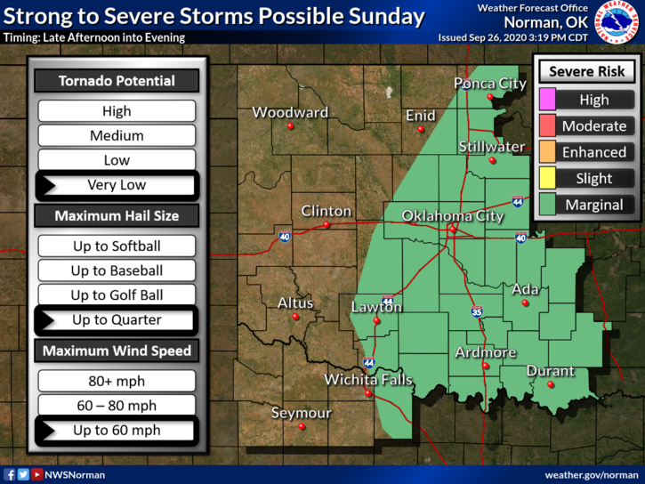
1-We are on the western edge of a MARGINAL RISK but in a GENERAL RISK area for possibly severe weather later today. If storms do occur, quarter size hail or slightly larger are the threats per guidance. Overall, for our area, we’ll be ok but we’ll monitor conditions throughout the day.
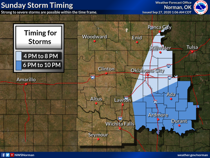
2- We are looking at roughly 11am through late this afternoon for storms if they occur. All of this is due to a cold front that will push into the area around the 1100-1300L time frame. Winds will be gusty this morning and will increase after frontal passage from the NNE. Wind speeds 20-30 mph with higher gusts can be expected. The main thing with this front will be dropping temperatures. Welcome to Fall. Another front is expected late Wednesday.
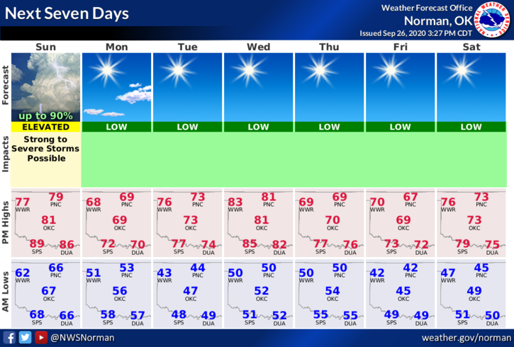
3- Here is your forecast from the NWS/NORMAN;
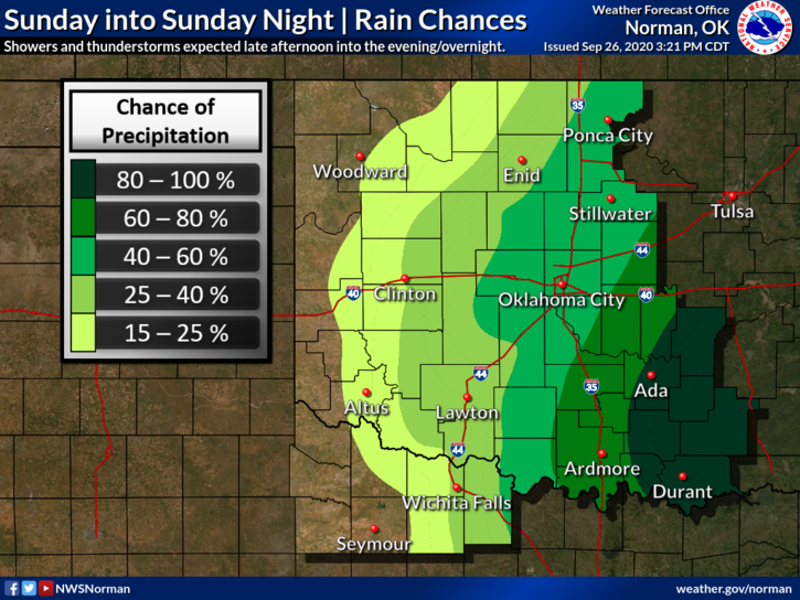
Sunday-Mostly cloudy. A slight chance of thunderstorms in the morning, then a chance of thunderstorms in the afternoon. Not as warm. Highs in the lower 80s. Southeast winds around 10 mph shifting to the northeast 10 to 20 mph in the afternoon. Chance of thunderstorms 50 percent.
Sunday Night-Partly cloudy. A slight chance of thunderstorms in the evening. Cooler. Lows in the lower 50s. North winds 10 to 20 mph. Chance of thunderstorms 20 percent.
HAVE A GOOD DAY!!
MIKE