0355L-SATURDAY OUTLOOK FROM GARFIELD COUNTY EMERGENCY MANAGEMENT-9/26/2020
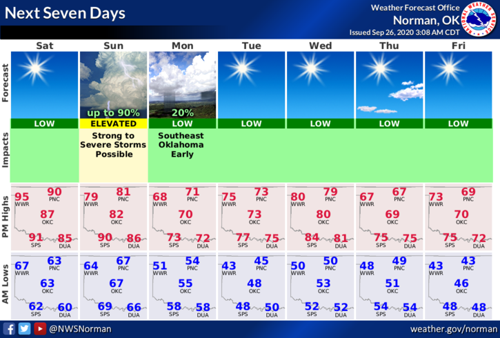
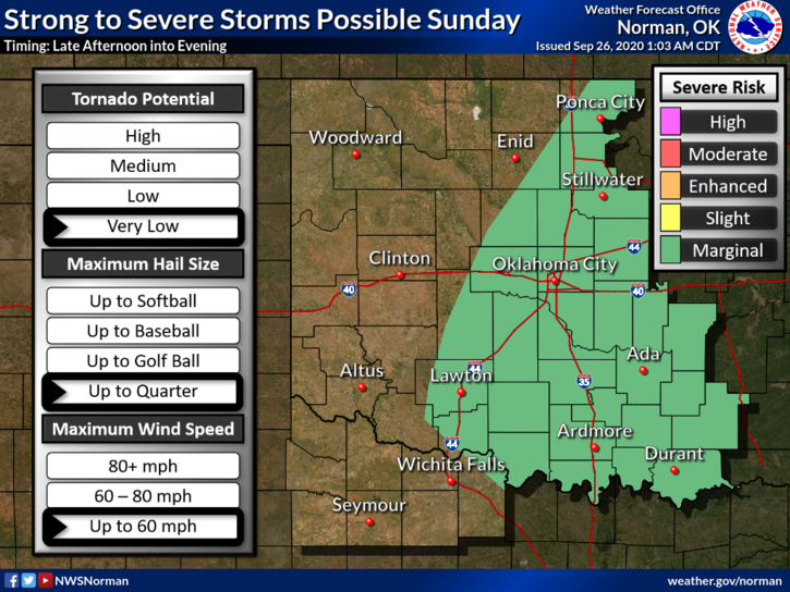
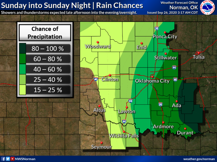
1-SUNNY, WINDY, AND WARM today with highs around 90. Enjoy today as this MIGHT be the last of the 90s for awhile. A cold front will push in Sunday and we’ll have a chance for some severe weather in the afternoon into the evening hours. Winds will become strong out of the north too, so secure things around the house that could take flight. IF storms do occur, the severe threat looks to be a low end event but more likely east of here per guidance. Low temps will drop into the 40s.
2- Another front will push in around mid-week cooling us down even more. We’ll see what happens for sure with this one. Overall, we’ll be ok. As stated yesterday, the fire danger will be increasing so be careful out there.
3- Here is your forecast from the NWS/NORMAN;
Saturday-Sunny, with a high near 91. South winds 15 to 20 mph, with gusts as high as 28 mph.
Saturday Night- Lows around 66. South wind 10 to 20 mph, with gusts as high as 24 mph.
HAVE A GOOD DAY!!
MIKE