0405L-SUNDAY OUTLOOK FROM GARFIELD COUNTY EMERGENCY MANAGEMENT-6/20/21
1-WARNING!! We apparently have another fire starter in the area. We were called out on a wheat field fire last night near Hillsdale and ended up fighting 2 wheat field fires, the other north of Carrier. The fire up west of Hillsdale was UNCUT WHEAT. The fire north of Carrier was wheat stubble. Thank you to Lahoma and Kremlin Fire for the assistance you provided.
2-Law enforcement told us that Grant County had around 15 fires last night. Anyone in Grant County that can add information to this would be helpful. This said, WE ARE ASKING ALL RURAL RESIDENTS KEEP AN EYE OUT FOR SUSPICIOUS ACTIVITY. If you see any, call the Sheriff’s office or 911 immediately.
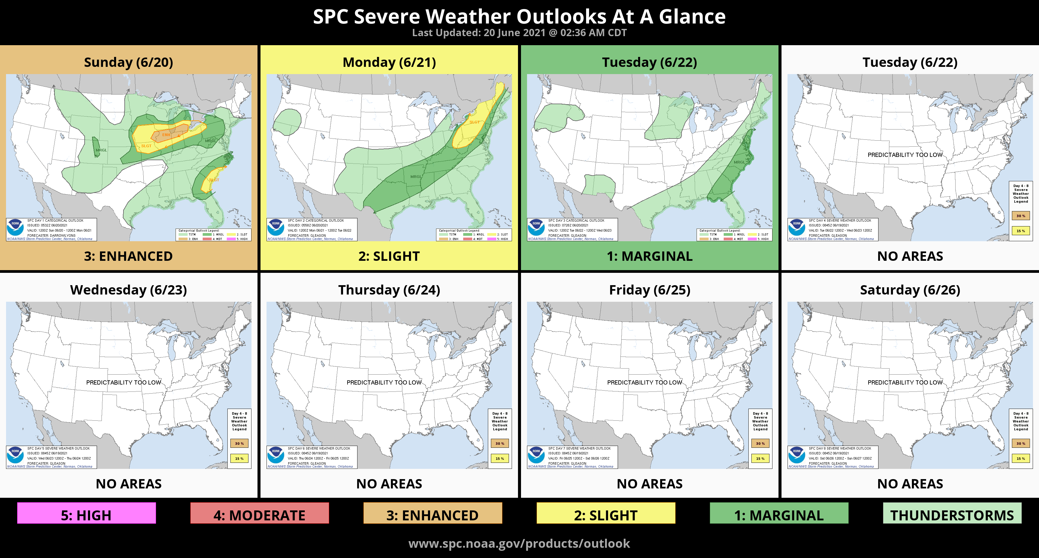
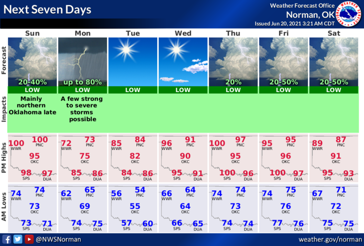
3-Weather-wise; HOT and WINDY today as a cold front continues to move our way. It MIGHT bring a chance for rain this evening but a higher probability after midnight tonight. We’ll see what happens. High temps on Monday look to be around 70! Here is your forecast from the NWS/NORMAN;
Today-Mostly sunny. Highs around 102. Southwest winds 10 to 20 mph.
Tonight-Mostly clear. A slight chance of thunderstorms in the evening, then a chance of showers and a slight chance of thunderstorms after midnight. Cooler. Lows in the mid-60s. South winds 10 to 20 gusting to 25 mph shifting to the north 10 to 15 mph after midnight. Chance of precipitation 30 percent.
FINALLY, be sure and download our GARFIELD COUNTY EM app. It just might save your life!
HAVE A GOOD DAY!
MIKE