0300L-SATURDAY OUTLOOK FROM GARFIELD COUNTY EMERGENCY MANAGEMENT-4/23/22
WIND ADVISORY remains in effect from now 0230L until 1900L Saturday evening.
1- Here is your forecast from the NWS/NORMAN;
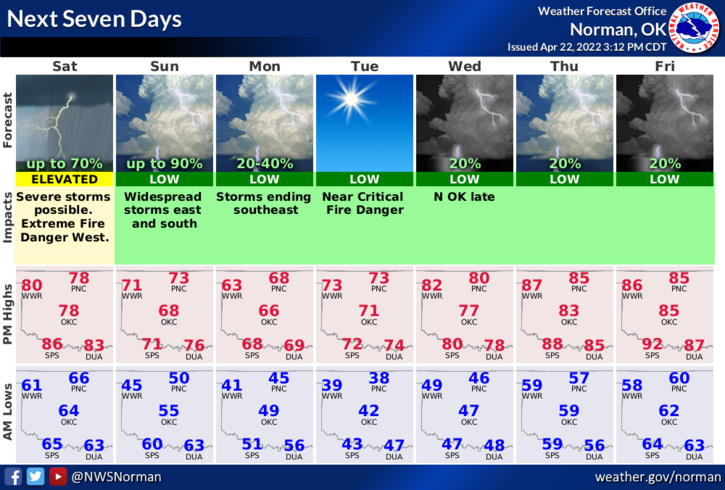
Today-Partly sunny. A slight chance of showers and thunderstorms this morning and this afternoon. Windy with highs in the lower 80s. South winds 25 to 30 mph with gusts up to 40 mph. Chance of rain 50 percent.
Tonight-Partly cloudy. A slight chance of showers and thunderstorms in the evening. Breezy with lows around 50. South winds 15 to 25 mph with gusts up to 35 mph, becoming west 10 to 15 mph with gusts up to 25 mph after midnight. Chance of rain 20 percent.
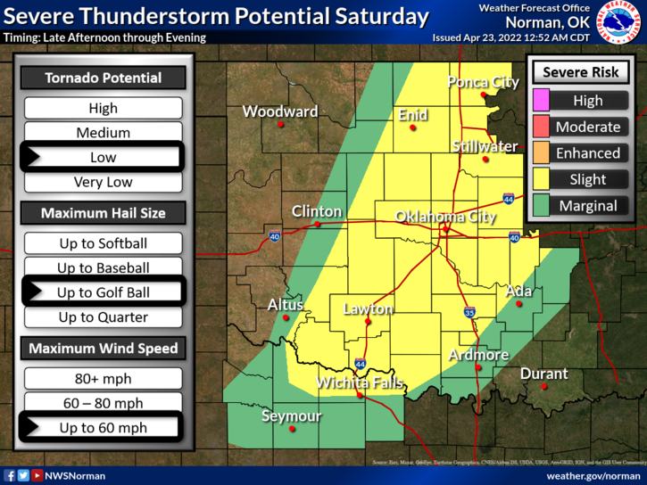
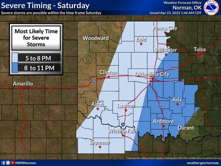
2- IN A NUTSHELL, SEVERE weather is possible later today as a dryline pushes towards and through our area late this afternoon. ALL HAZARDS will be possible if storms get going. It will be close for the severe threat as models show storms will be more prevalent closer to I-35 and eastward. We’ll watch this closely.
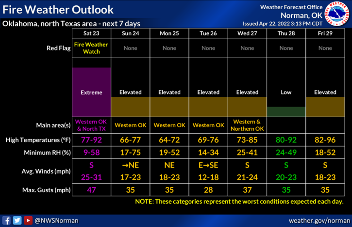
4- After dryline passage, we’ll be very windy and dry so the FIRE DANGER will increase overnight as rain chances lessen. Here is a link to today’s early morning discussion if you want to read it for yourselves: https://forecast.weather.gov/product.php?site=OUN&issuedby=OUN&product=AFD&format=CI&version=1&glossary=1
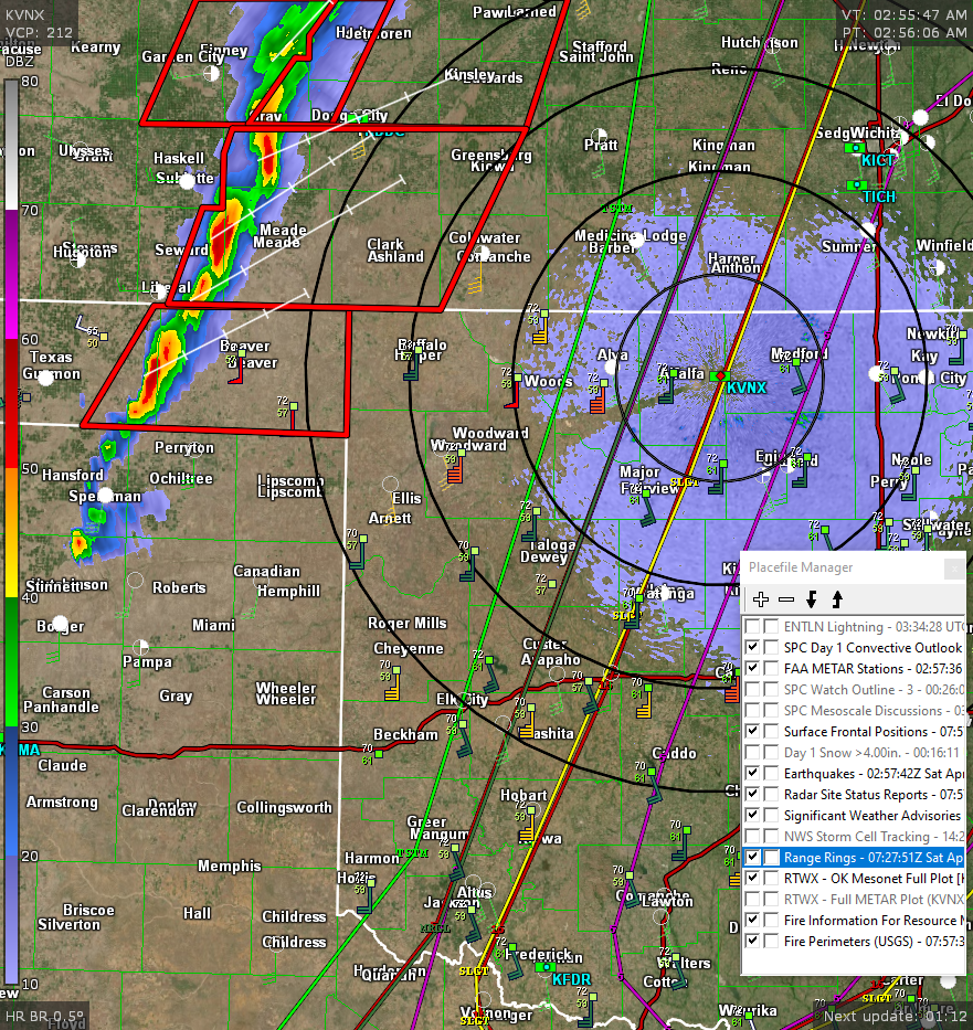
5- Overall, we’ll be ok and be sure to report ANY smoke or fire that you see. We have ongoing severe storms out in the Panhandle, SEE LAST GRAPHIC FROM 0300L. These are moving ENE but as they back build, we might see some activity HOPEFULLY later this morning. Not holding my breath, but hoping…
HAVE A GOOD DAY!