0325L-FRIDAY OUTLOOK FROM GARFIELD COUNTY EMERGENCY MANAGEMENT-02/24/23
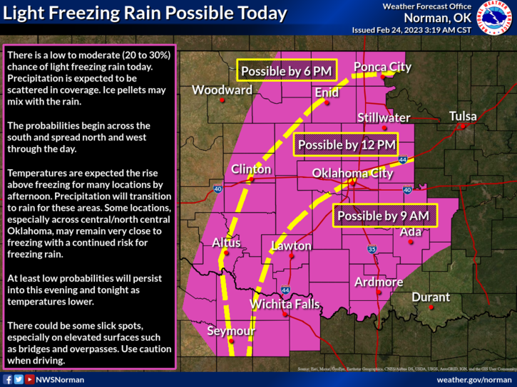
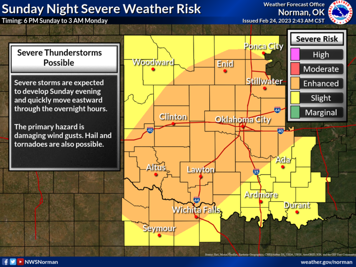
* Partly cloudy and cold for today. There might be some freezing precip later today so look at the graph attached. The situation for the severe event forecast for Sunday is still not set in stone. Many variables still up in the air, so as this all comes together, we just have to wait as this system gets closer. We have a briefing each day into Sunday so we’ll send out updates accordingly.
* WHAT CAN YOU DO? First- no need to panic. Media folks will panic people enough. Second- I have talked preparedness for years. What is YOUR plan? Make these decisions now so if and when the worse might occur, you already know what to do. Most folks don’t prepare and they are the ones who get into a bind. Plan now while your calm. Making decisions while under stress is very difficult for most.
*WILL THE WORST HAPPEN? Don’t know. The NWS is keeping a close eye on this and passing info to us and in turn we pass that to you. This Sunday is a 50/50 chance for us to have severe weather. If you want to keep up with discussions, here is a link to the NWS/NORMAN- https://www.weather.gov/oun/ Also here is a link to the Storm Prediction Center- https://www.spc.noaa.gov/
* Overall, we’ll be ok so here is your forecast from the NWS/NORMAN:
* Today- Mostly cloudy with a slight chance of freezing rain. A slight chance of sleet this afternoon. Highs in the lower 30s. Northeast winds 10 to 15 mph. Chance of precip. 20 percent.
Tonight-Mostly cloudy. Cold with lows in the mid-20s. Northeast winds around 5 mph.
HAVE A GOOD DAY!!