0400L-THURSDAY OUTLOOK FROM GARFIELD COUNTY EMERGENCY MANAGEMENT-02/23/23
*GARFIELD COUNTY EM is our Notification and Preparedness app. You’ll most likely need it this weekend so download it today.
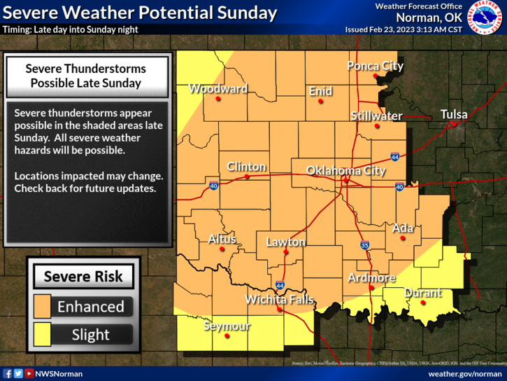
*We have gone from really nice temps back into the freezer and then this weekend to nice temps with a strong possibility for severe weather. There are a few details that haven’t come together for Sunday per guidance but as changes occur, I will send them out over our GARFIELD COUNTY EM APP. This Sunday’s severe potential does call for ALL HAZARDS so keep this in mind. All Hazards mean- torrential rainfall, hail, high winds, and possible tornadoes. NO NEED TO PANIC, the tv folks will panic everyone enough. For today, wear a coat and we’ll advise as needed.
* Overall, we’ll be ok so here is your forecast from the NWS/NORMAN;
Thursday- Sunny, with a high near 37. North wind 9 to 15 mph, with gusts as high as 23 mph.
Thursday Night- Increasing clouds, with a low around 21. Northeast wind 9 to 13 mph, with gusts as high as 20 mph.
* FINALLY; I will work on doing a video for you all, as we near the Sunday timeframe.
HAVE A GOOD DAY!