0315L-SUNDAY OUTLOOK FROM GARFIELD COUNTY EMERGENCY MANAGEMENT-8/20/23
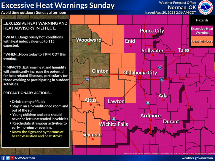
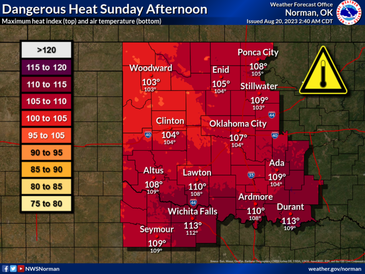
*EXCESSIVE HEAT WARNING IN EFFECT TODAY & MONDAY FROM NOON UNTIL 9PM. Heat index values up to 112 are possible. I am beginning to feel like a toasted broken record! Stay hydrated out there.
*The Fire danger is slowly increasing out there, so if you see smoke and/or fire, call 9-1-1.
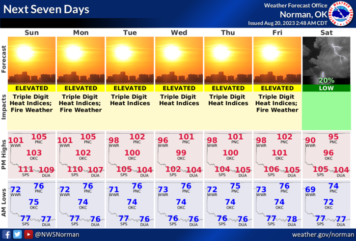
*Overall, we will remain hot so take precautions if you plan on working outdoors. See attached graphs. Here is your forecast from the NWS/NORMAN;
Today- Sunny, hot with highs around 104. Southwest winds 5 to 10 mph.
Tonight- Clear. Lows in the mid-70s. South winds 5 to 10 mph. Heat index values up to 106 early in the evening.
**NOTE- It appears we will be at least at 100 degrees or higher all week with heat index numbers a little higher. Just use good common sense and pay close attention to how you are feeling while outdoors. Nothing you do in extreme heat is worth your life so take your time by pacing yourselves and take breaks.
*Conducting a controlled burn? Call dispatch first at 580-234-(FIRE)-3473.
This post can be found under GCEM Blog on the GARFIELD COUNTY EM app. It can also be found on the front page of our website at https://gcem.org
HAVE A GOOD DAY!