0305L-SATURDAY OUTLOOK FROM GARFIELD COUNTY EMERGENCY MANAGEMENT-8/19/23
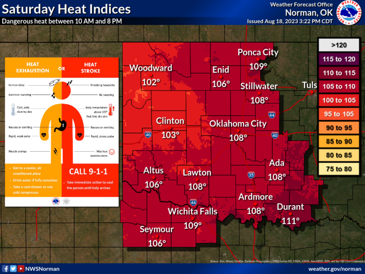
*Excessive Heat Warning in effect from 1pm until 9pm this evening for temperatures up to 109 and heat index values up to 110 expected.
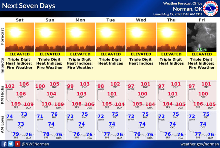
*A HEAT ADVISORY will be in effect from NOON until 9pm on Sunday.
*The large upper high will remain over the area for at least the next week or so. There are indications, per guidance, that it will slowly start a move to the northeast during the week. We’ll see what happens. It’s summertime so just expect the heat. I can remember several summers where the heat was worse. We’ll survive this and remember, in a few months, it will be a lot cooler out there.
*Here is your forecast from the NWS/NORMAN;
Today-Sunny, hot with highs around 106. Southwest winds 5 to 10 mph with gusts up to 20 mph.
Tonight-Mostly clear. Lows in the mid-70s. South winds 5 to 10 mph. Heat index values up to 107 early in the evening
*Conducting a controlled burn? Call dispatch first at 580-234-(FIRE)-3473 and if you see smoke or fire, call 9-1-1
*Download our GARFIELD COUNTY EM app and click on the GCEM Blog icon. You will find my daily posts there AND on the front page of our website at https://gcem.org
HAVE A GOOD DAY!