0330L-SUNDAY OUTLOOK FROM GARFIELD COUNTY EMERGENCY MANAGEMENT 03/24/24
Download our GARFIELD COUNTY EM app as you’ll receive advisories and warnings “directly” from the NWS, IN DETAIL. You’ll also receive information from us.
**NO CONTROLLED BURNING TODAY**
*HIGH WIND WARNING IN EFFECT FROM 7AM UNTIL 4PM THIS AFTERNOON. SOUTH WINDS 20-30 WITH GUSTS TO 60 MPH ARE EXPECTED. A WIND ADVISORY FROM 4PM UNTIL 1 AM WITH WINDS 25-30 GUSTING TO 45 MPH IN EFFECT FOR THIS EVENING.
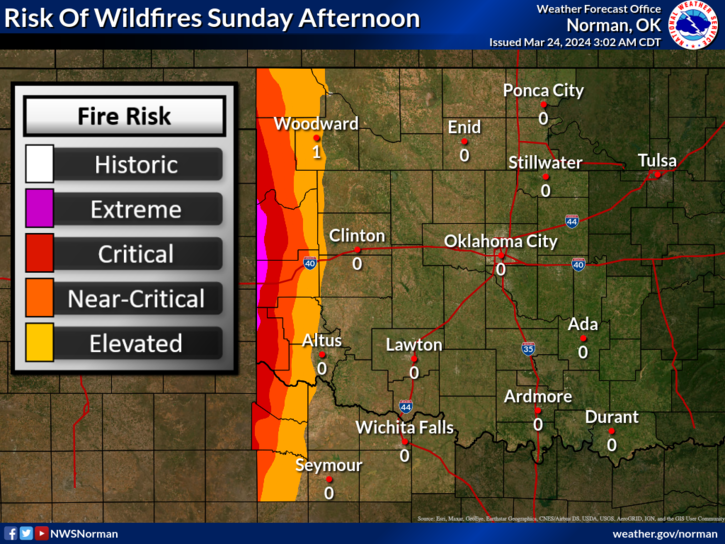
* A Red Flag Warning in effect in Beckham, Greer, and Harmon counties. It’s going to be a dangerous day from wind events, fire, and severe weather so just stay weather aware.
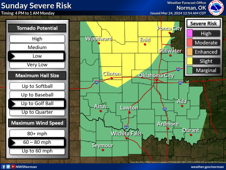
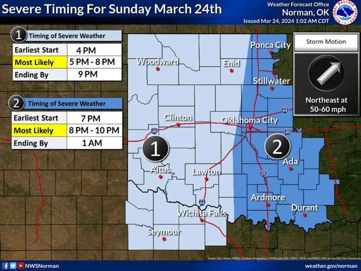
We are also in a SLIGHT RISK AREA for severe weather later this afternoon into the evening hours. ALL HAZARDS ARE POSSIBLE. Large hail, winds upwards of 75-80 mph, along with a low possibility for a few tornadoes. Some of the above may change so the main thing is not to panic and we’ll see how the forecast verifies as the day moves forward. See graphics attached. More graphics are here- https://www.weather.gov/oun/
Overall, we’ll be ok so we’ll keep an eye out and advise accordingly. Here is your forecast from the NWS/NORMAN;
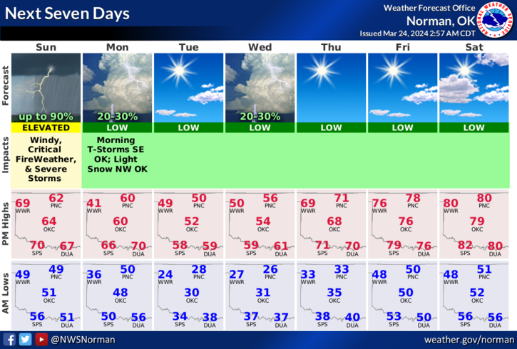
Today- Showers likely. A slight chance of thunderstorms this morning, then a chance of thunderstorms this afternoon. Some thunderstorms may be severe this afternoon. Windy with highs in the lower 60s. South winds 20 to 30 mph with gusts up to 50 mph. Chance of rain 70 percent.
Tonight- Mostly cloudy with showers likely with a chance of thunderstorms in the evening, then partly cloudy after midnight. Some thunderstorms may be severe. Windy with lows in the mid-40s. South winds 20 to 30 mph with gusts up to 45 mph. Chance of rain 60 percent.
HAVE A GOOD DAY!