0345L-TUESDAY UPDATE FROM ENID/GARFIELD COUNTY EMERGENCY MANAGEMENT-10/2/18
FIRST THOUGHT: WARM AND WINDY TODAY
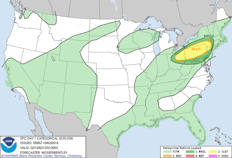
1- Several more days of warm temps and windy conditions then rain comes into the forecast. With moisture coming in from the gulf AND Pacific along with a few cold fronts, we look to receive some rainfall. Timing of the fronts and placement of the deeper moisture are still in question. This weekend is a forecaster’s nightmare since models are NOT in agreement as to what will or will not occur and where exactly rain will occur.
2- Since major questions are still out there, I personally wouldn’t worry too much about the high rainfall totals yet until the models come into better agreement. This far out there remains too many questions. I would keep a close eye on the forecast since there are questions at this time. As with any rain event, especially if training occurs, there could be some flooding involved. We’ll see how the forecast verifies and adjust accordingly. For now, don’t panic but dust off your umbrellas, just in case.
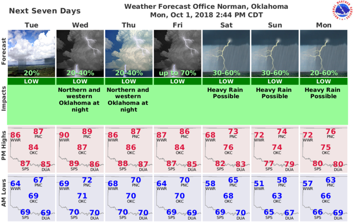
3- Here is your forecast from the NWS/NORMAN;
Tuesday-Mostly sunny, with a high near 86. South wind 10 to 20 mph, with gusts as high as 25 mph.
Tuesday Night-Partly cloudy, with a low around 72. South wind 15 to 20 mph, with gusts as high as 25 mph.
Finally, get our GARFIELD COUNTY EM app, you’re not prepared without it.
HAVE A GREAT DAY!!
MIKE