0420L-WEDNESDAY UPDATE FROM ENID/GARFIELD COUNTY EMERGENCY MANAGEMENT-10/3/18
HOT AND WINDY TODAY SO SECURE ANYTHING THAT COULD TAKE FLIGHT
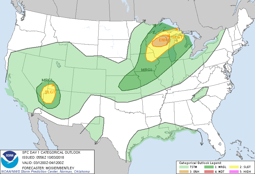
1- A few more days of warm to hot temps then we cool off and rain chances go up. There may be a chance to see some rain along the OK/KS border later today but we’ll see where the front pushes at that time.
2- It will rain and we may see storms over the next 4-5 days. We’ve seen this before so no need to panic. Some storms could be severe due to hail and winds but the tornado threat APPEARS to be very low right now. We’ll watch and see how all of this mess comes together. It’s still complicated and the models are not in total agreement.
3- For now, enjoy the warmer temps. Here is your forecast from the NWS/NORMAN;
Wednesday-Mostly sunny. Highs around 90. South winds 15 to 25 mph gusting to 35 mph.
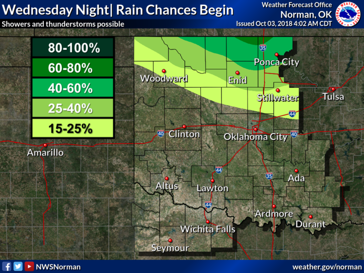
Wednesday Night-Partly cloudy. A slight chance of thunderstorms in the evening, then a chance of thunderstorms after midnight. Lows in the upper 60s. South winds 10 to 15 mph. Chance of thunderstorms 50 percent.
HAVE A GOOD DAY!!
MIKE