0400L-MONDAY UPDATE FROM ENID/GARFIELD COUNTY EMERGENCY MANAGEMENT-10/1/18
STORM SIREN TEST IN ENID AND BRECKENRIDGE TODAY AT NOON, DEPENDING ON CLOUD COVER.
1-DISASTER– What is your definition of this word in a picture? Our seminar is a month away. I am working on my presentation. I need 5 pictures. Email me “your depiction of disaster” and if I use yours, I have a little something for you. A disaster could be a destroyed room by the kids before guests arrive, a wreck, a fallen tree, a bad hair day, a dropped pizza, a burned steak-which could be depressing too. Keep it clean though!! You can post them on Facebook as a JPEG or email them to me. No ATTACHED files. Copy and paste would be great. mike@gcem.org is my email.
2-Our seminar this year builds on what we did last year but better. You will learn a lot and understand what goes on behind the scenes when events occur, so I would like to see at least 1 person from each business in the region here this year. NOT for numbers but to help you all understand that preparedness is important BEFORE an event. You practice preparedness every day whether you realize it or not so R.S.V.P. to me using the above email so I can add you to the list. Want to make sure we have enough to eat for lunch. It’ll be really good. Looking forward to seeing you all.
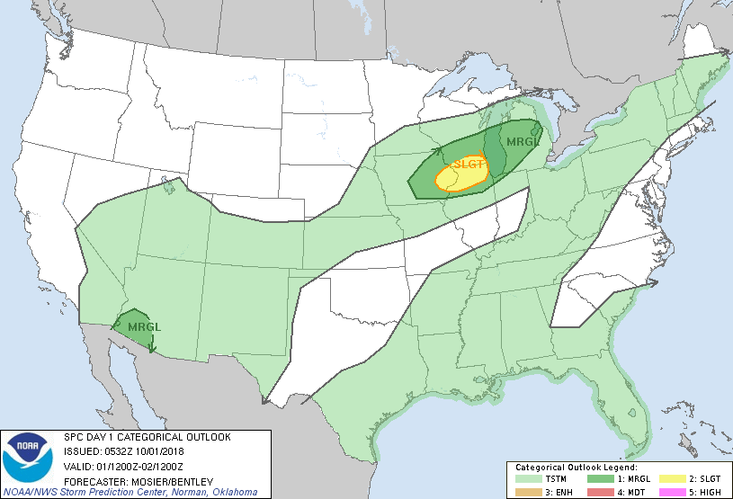
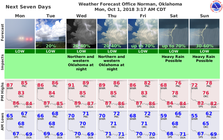
3-Weather-wise, warm to hot with humid conditions then it appears we will be dealing with rain this weekend. We’ll keep an eye out. Here is your forecast from the NWS/NORMAN;
Monday: Partly cloudy with highs in the mid-80s. South winds 10 to 15 mph gusting to 25 mph at times.
Monday Night: Partly cloudy. Some areas could see some drizzle after midnight. Lows around 70 with south winds around 10 mph.
HAVE A SUPER DAY
MIKE