0255L-WEDNESDAY OUTLOOK FROM GARFIELD COUNTY EMERGENCY MANAGEMENT- 4/23/25
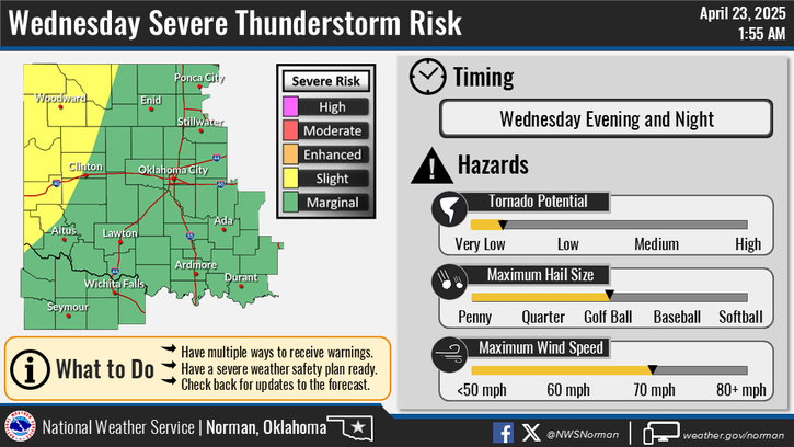
We are in a MARGINAL RISK for severe weather all week. Hail and winds are the main risks and the tornado risk is very low. These events will occur mostly at night as it appears right now. There are a lot of factors going on right now atmospherically so if you want super detailed info, you can go to the Storm Prediction Center web site and the Weather Prediction Center site too. Both can be found here along with a lot of other information- https://gcem.org/links/
Overall, we’ll be ok. Here is your forecast from the NWS/NORMAN:
Today- Partly sunny. A slight chance of showers and thunderstorms this morning, then a chance of showers and thunderstorms this afternoon. Highs in the upper 70s. South winds 10 to 15 mph. Chance of rain 50 percent.
Tonight- Mostly cloudy with a chance of thunderstorms. A chance of showers in the evening, then showers likely after midnight. Lows in the upper 50s. Southeast winds 10 to 15 mph. Chance of rain 70 percent.
Be sure to download our GARFIELD COUNTY EM app. NWS warnings and advisories come through in detail automatically and you’ll get important info from us too.
HAVE A GOOD DAY!