0415L-TUESDAY UPDATE FROM GARFIELD COUNTY EMERGENCY MANAGEMENT-1/30/18
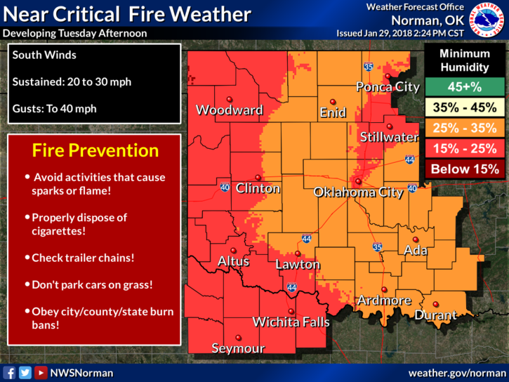
RED FLAG FIRE WARNING IN EFFECT FOR TODAY. BURNING OF ANY KIND IS “NOT ADVISED.” THIS WARNING IS IN EFFECT FROM 11 AM UNTIL 7PM.
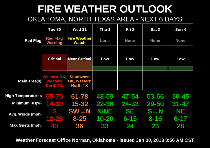
The fire danger will be around until we green up this spring so just be careful out there. We will be dealing with a few cold fronts this week and as they approach, the winds will increase, thus the warnings and alerts. We don’t expect any precip with these fronts so continue to keep your eyes peeled for smoke and fire. REPORT ANY SMOKE OR FIRE TO 911 IMMEDIATELY.
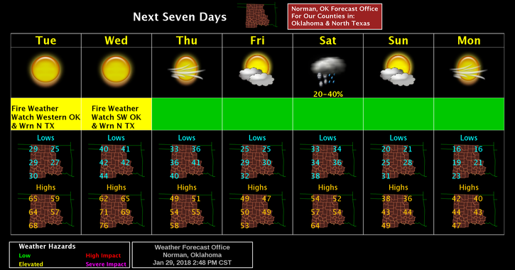
Here is your forecast from the NWS/NORMAN;
TUESDAY-Sunny, with a high near 58. South wind 10 to 15 mph increasing to 20 to 30 mph in the afternoon. Winds could gust as high as 35 mph.
Tonight-Mostly clear, with a low around 40. South wind 15 to 20 mph, with gusts as high as 28 mph.
Finally, the cold fronts will bring colder air and bring our temps down to normal, whatever that might be!!
HAVE A GOOD DAY AND WEAR PANTS.
MIKE