MONDAY/CHRISTMAS DAY OUTLOOK FROM ENID/GARFIELD COUNTY EMERGENCY MANAGEMENT-12/25/18
1-“MERRY CHRISTMAS” TO EVERYONE!!
2- GARFIELD COUNTY EM. This is our notification app. Download it, learn it, and now you’ll be prepared with it. Now you’re as prepared as possible to receive information directly from OUR office.
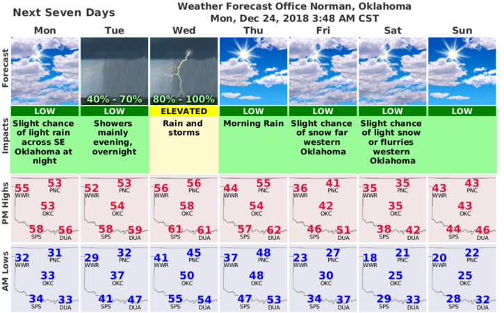
3- Quick overview: rain is possible later this evening into the overnight hours. Wednesday MIGHT be a little stormy with thunderstorms around the region with the main threat of hail Wednesday evening. Maybe is a good word for this right now. Thursday is transition day with the main system leaving and a cold front affecting us late Thursday into Friday. Remember when I said, keep your coats handy? Friday is that day!!
4- Here is your forecast for today from the NWS/NORMAN;
Christmas Day- Partly sunny with a high near 54. Northwest wind 5 to 10 mph becoming east in the afternoon.
Tuesday Night- A chance of rain before midnight, then showers after midnight. Low around 45. East wind 5 to 54 mph, with gusts as high as 20 mph. Chance of precipitation is 80%. New precipitation amounts between a tenth and quarter of an inch possible.
HAVE A VERY MERRY CHRISTMAS
MIKE