0430L-EASTER SUNDAY UPDATE FROM ENID/GARFIELD COUNTY EMERGENCY MANAGEMENT-4/01/18
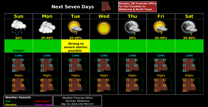
1-COOLER TODAY with highs in the mid to upper 30’s. Tonight, we’ll be in the upper 20’s. If you have planted new plants recently, cover them up for tonight and Monday night.
2-Another cold front will come through on Tuesday and yet another on Friday. Precip amounts will be very light if at all until Friday when we stand a better chance for rain. We’ll see how the forecast verifies.
3-Keep a coat in the car and an umbrella handy, just in case.
4-Here is your forecast from the NWS/NORMAN;
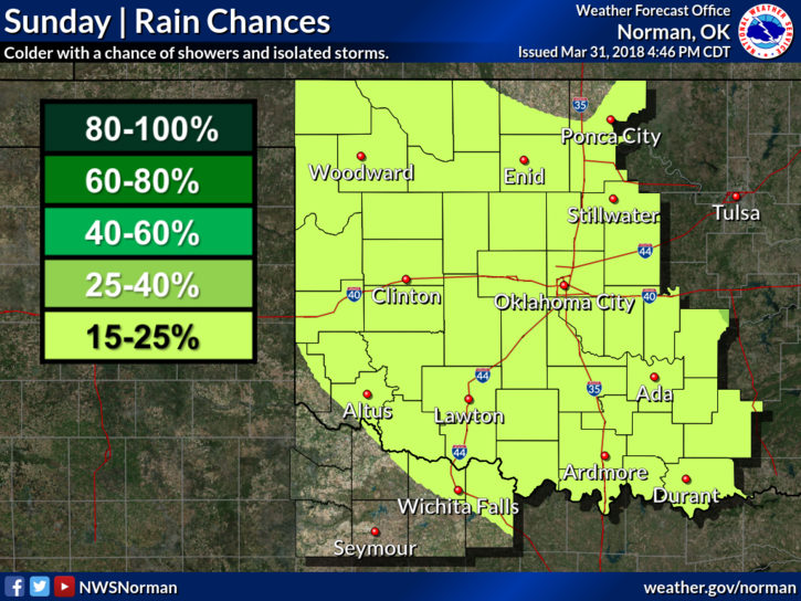
Sunday-Patchy drizzle with a slight chance of showers between 7am and noon. Cloudy, with a high near 37. North northeast wind 10 to 20 mph, with gusts as high as 25 mph. Chance of precipitation is 20%.
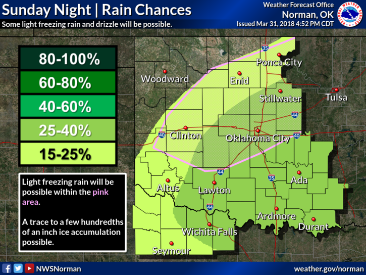
Sunday Night-Slight chance of rain or freezing drizzle after 1am. Mostly cloudy, with a low around 27. Northeast wind 5 to 15 mph. Chance of precipitation is 20%.
STAY WARM AND HAVE A GREAT DAY!!
MIKE