0420L-MONDAY UPDATE FROM ENID/GARFIELD COUNTY EMERGENCY MANAGEMENT-4/2/18
1-FREEZE WARNING IN EFFECT UNTIL 10AM THIS MORNING. Freezing precip isn’t expected but stay aware in the event drizzle does occur.
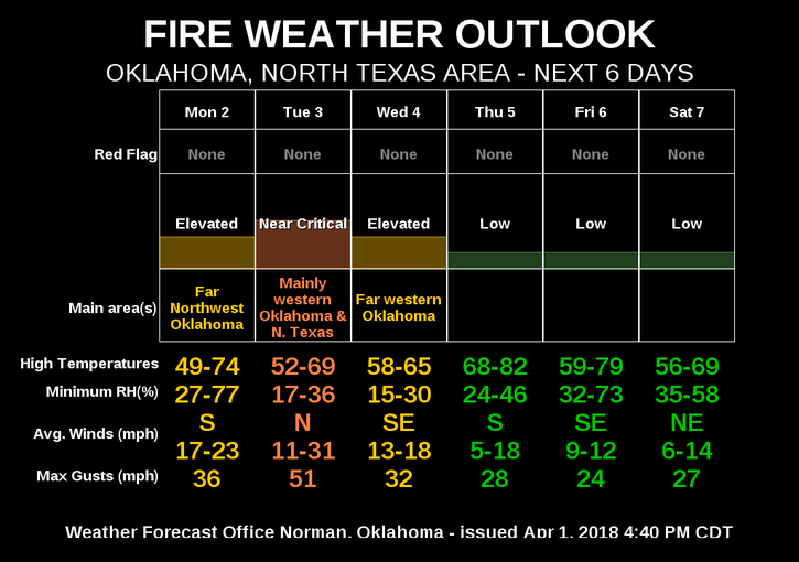
2-FIRE WEATHER concerns are back close to the ELEVATED level. Winds will be strong so any burning right now is NOT RECOMMENDED.
3-Storm siren test today in Enid and Breckenridge at noon if skies are mostly clear.
4- Here is your forecast from the NWS/NORMAN;
Monday-Areas of drizzle or freezing drizzle between 7am and noon. Cloudy, then gradually becoming mostly sunny with a high near 52. East wind 5 to 10 mph becoming south 15 to 25 mph in the afternoon. Winds could gust as high as 30 mph.
Monday Night-Partly cloudy with a low around 50. Windy with a south wind 20 to 25 mph, with gusts as high as 36 mph.
HAVE A GREAT DAY!!
MIKE