0410L-SATURDAY UPDATE FROM ENID/GARFIELD COUNTY EMERGENCY MANAGEMENT-3/31/18
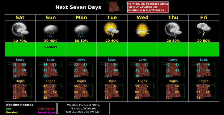
1-AN ARCTIC COLD FRONT is coming with low chances for precipitation. The BAD thing on precipitation is that we could see FREEZING RAIN/DRIZZLE late Sunday evening into Monday. Temps will drop dramatically for Sunday and Sunday night.
2-Per NWS GUIDANCE, the forecast is complicated so MY ADVICE is simple; enjoy today but prepare for much colder temps for Sunday. Be prepared for the POSSIBILITY of freezing precipitation late Sunday into Monday. If we get some freezing precip late Sunday into Monday, SLOW DOWN and drive carefully.
3- This forecast may change some but colder temps are definitely coming back. The forecast below includes Sunday so we’ll see whether or not this verifies.
Saturday-Sunny with highs near 71. South winds 10 to 15 mph gusting to 25mph becoming north in the afternoon.
Saturday Night-Increasing clouds, with a low around 33. Northeast winds around 16 mph, gusting to 25mph..
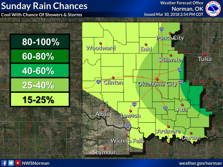
Sunday-20 percent chance of showers before 1pm. Cloudy, with a high near 40. Northeast winds 10 to 20 mph gusting to 25 mph.
Sunday Night-Slight chance of rain or freezing rain after 1am. Mostly cloudy, with a low around 31. East northeast wind 5 to 10 mph. Chance of precipitation is 20%.
Download our GARFIELD COUNTY EM app. You may need it this weekend!!
HAVE A SUPER DAY!!
MIKE