0325L-FRIDAY OUTLOOK FROM GARFIELD COUNTY EMERGENCY MANAGEMENT-4/01/22
PREPAREDNESS starts and ends with “GARFIELD COUNTY EM”
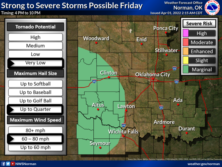
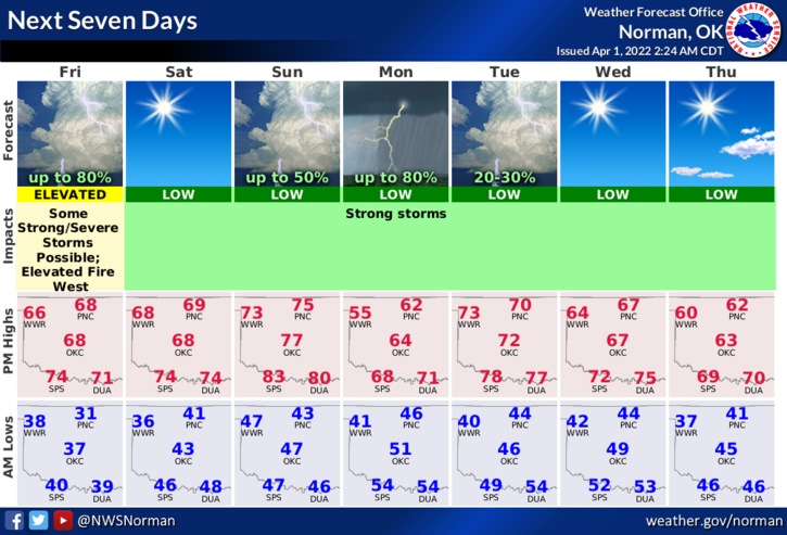
1- Warmer today and windy. A storm system moving in from the west and a cold front approaching the area later tonight will give us a possibility for rain later this afternoon and overnight. Amounts don’t look really good but if storms occur, the wind most likely will be the main threat.
2- Saturday and most of Sunday look pretty good except for additional rain chances. The Southeastern part of the state has that better chance for rain Sunday afternoon. We’ll see what happens as the forecast verifies.
3- The FIRE DANGER is still out there as foliage is very dry. Use extreme caution while utilizing anything related to fire. Overall, we’ll be ok so here is your forecast from the NWS/NORMAN;
Today-Mostly sunny. A chance of rain showers this afternoon. Highs in the upper 60s. South winds 15 to 20 mph with gusts up to 30 mph. Chance of rain 30 percent.
Tonight-Slight chance of thunderstorms. Showers likely, mainly in the evening. Lows around 40. Southeast winds 15 to 20 mph with gusts up to 30 mph, becoming west 5 to 10 mph after midnight. Chance of rain 70 percent.
HAVE A GOOD DAY!