0420L- FROM ENID/GARFIELD COUNTY EMERGENCY MANAGEMENT-4/13/18
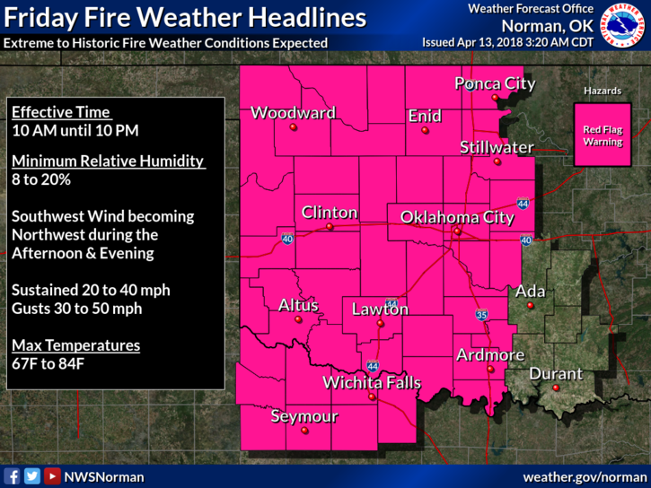
1-RED FLAG FIRE WARNING IN EFFECT FROM 10 AM UNTIL 10PM TONIGHT. VERY DANGEROUS CONDITIONS ARE OCCURRING OUT WEST AND THOSE CONDITIONS WILL BE MOVING OUR WAY THIS MORNING. Conditions are very low humidity with shifting winds that will occur with the dryline and cold front that will move through the area later this morning and early this afternoon.
2-As stated last night, Garfield County Task Force 3 was sent to the Woodward/Mooreland Fire last night and our Task Force 1 will be leaving around 4 am to replace them. TF-1 consists of crews from Garber, Hillsdale, Fairmont, and Waukomis. These fire departments are volunteer. Keep all of them in your thoughts and prayers. We have placed all departments in the county on high alert so we do have plenty of response capability here in case anything occurs.
3- Task forces from Grant, Alfalfa, Major, and Woods counties along with many others are out on the various fires too. If you plan on traveling, watch out for emergency vehicles.
4- Please be extremely careful today and REPORT ANY FIRE OR SMOKE TO 911.
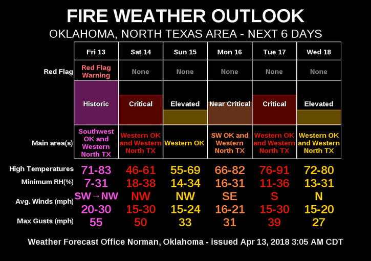
5-Here is your forecast from the NWS/NORMAN;
Friday-Partly sunny, then gradually becoming sunny, with a high near 78. Windy, with a south wind 15 to 25 mph increasing to 25 to 35 mph in the afternoon. Winds could gust as high as 45 mph.
Friday Night-Partly cloudy, with a low around 35. Windy, with a west wind 20 to 30 mph decreasing to 15 to 20 mph in the evening. Winds could some gusts as high as 40 mph.
6-Finally, once again, the dryline should push through the area later this morning and the cold front should push through early this afternoon.
HAVE A GOOD DAY!!
MIKE