0430L-SATURDAY UPDATE FROM ENID/GARFIELD COUNTY EMERGENCY MANAGEMENT-4/14/18
1-WIND ADVISORY IN EFFECT UNTIL 8PM TONIGHT.
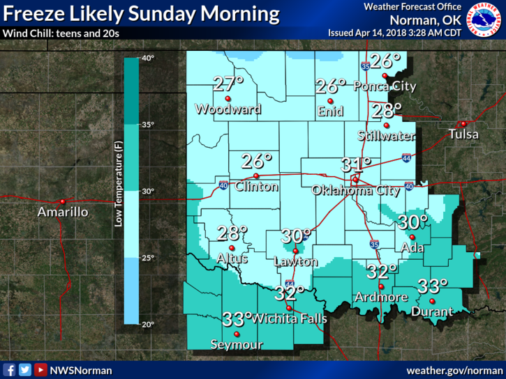
2- FREEZE WATCH IN EFFECT FROM LATER TONIGHT INTO SUNDAY MORNING.
3- For those wanting to haul supplies, thank you but we have that covered right now. If we do need additional help, I WILL contact you. That said, I might have additional needed items after I talk to Incident Command in Seiling this morning. I will post those here after that discussion.
4- CUDO’S to all companies that have donated and sent those items to other areas. Just remember that driving into a fire complex area is dangerous so be EXTREMELY careful.
5- Garfield County TASK FORCE #3 WILL RE-DEPLOY SHORTLY and go to Seiling. Task force #2 will be coming home shortly. Task Force #1 will re-deploy late this afternoon if needed. Task Force coordinators along with Emergency Management officials will meet to discuss future deployments and personnel requirements as needed.
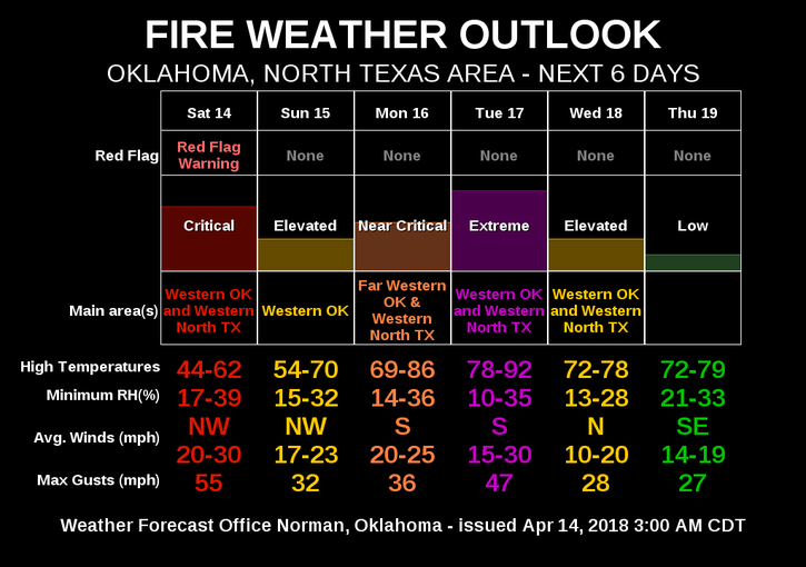
6- Here is your forecast from the NWS/NORMAN;
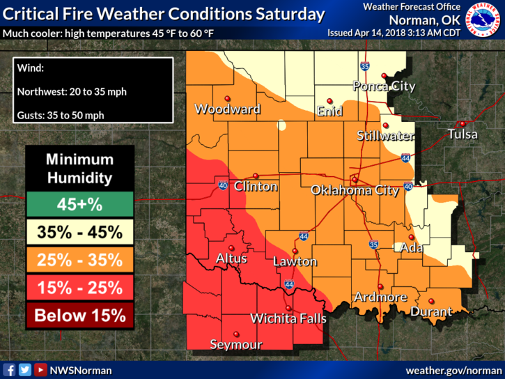
Saturday-Mostly cloudy, with a high near 46. Windy, with a northwest wind 25 to 35 mph, with gusts as high as 45 mph.
Saturday Night-Cloudy during the early evening, then gradual clearing, with a low around 26. Windy, with a north northwest wind 20 to 30 mph decreasing to 15 to 20 mph after midnight. Winds could gust as high as 40 mph.
KEEP EVERYONE FIGHTING THE FIRE, THOSE TAKING SUPPLIES, WITH THOSE HANDLING LOGISTICS, AND THOSE CARING FOR THOSE WHO HAVE LOST ANYTHING, IN YOUR THOUGHTS AND PRAYERS.
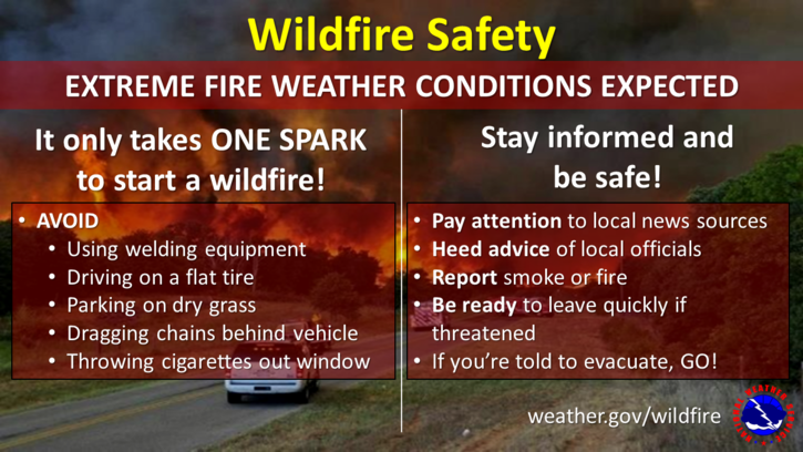
WE’LL ADVISE AS NEEDED. STAY SAFE AND REPORT ANY SMOKE OR FIRE TO 911 IMMEDIATELY.
MIKE