FROM GARFIELD COUNTY EMERGENCY MANAGEMENT-FRIDAY 4/28/17
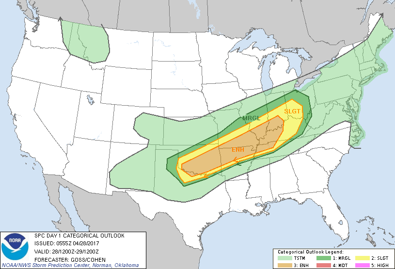
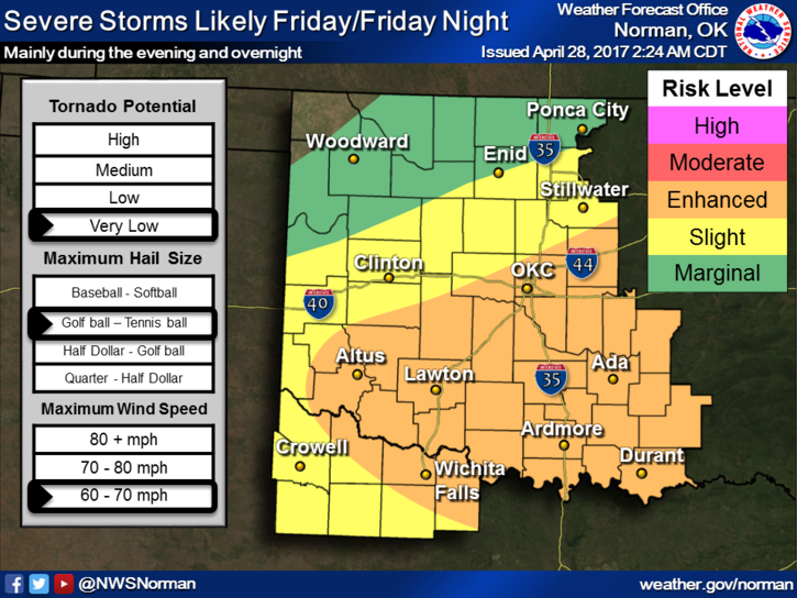
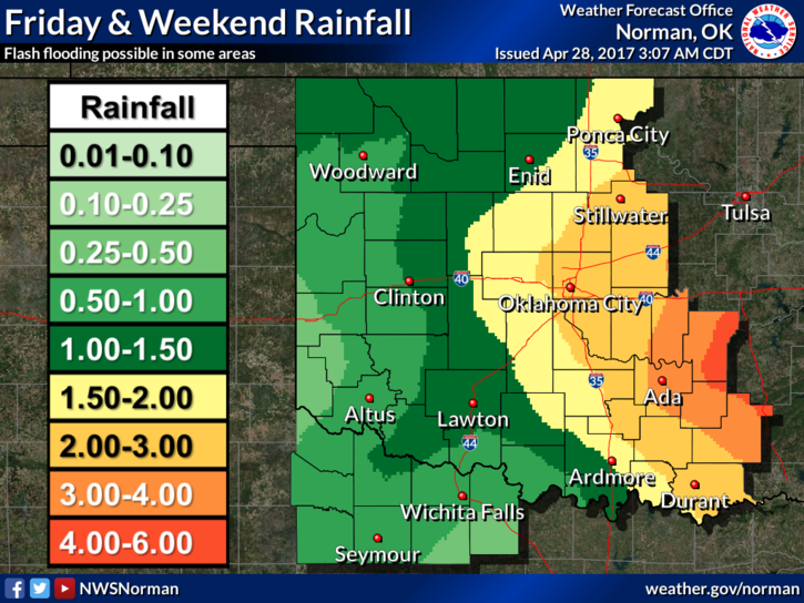
It’s Friday and we are in a SLIGHT RISK for severe weather LATER THIS EVENING and possibly overnight. Our risks will be large hail, damaging winds, and if we get training storms, flooding. Per NWS guidance, we could receive up to 2 inches of rain or so. The “CAP” will be strong today and without any fast moving boundaries out there moving into the area causing convergence, the cap will most likely hold until later this evening. Enjoy the day and expect rain later this evening off and on until sometime on Sunday.
The key factor is no need to panic so just stay weather aware and you’ll be ok. Don’t let the hype get the better of you. A few questions that have been asked, Will we really have severe weather? YES. Will we have alot of tornadoes? NO. Will hail come through my roof? Not from these storms as it looks right now. WELCOME TO MY WORLD!! Folks, we’ll be ok. Don’t worry; just be prepared for torrential rainfall, some hail, and strong winds.
Here is your forecast for today;
30% chance for scattered showers before 7am this morning. After that time, partly cloudy with highs in the upper 60’s to low 70’s. Northwest winds around 10 mph.
Tonight-There is an 90% chance for thunderstorms. A few could be locally severe. Low temps around 48. East winds 10-20 mph gusting to 30 mph. Winds should become northerly after midnight.
Stay safe and have a great day. We’ll advise as needed.
MIKE