FROM GARFIELD COUNTY EMERGENCY MANAGEMENT-SATURDAY, 4/29/17
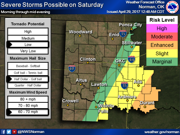
Severe thunderstorms have been wreaking havoc over the region all night. Here in Garfield County, we have had several lightning shows, some heavy rainfall and thunder along with gusty winds. The stronger storms, FOR THE MOST PART, have been to our south with large hail and damaging winds. Those appear to be staying mostly to our south. Not complaining at all.
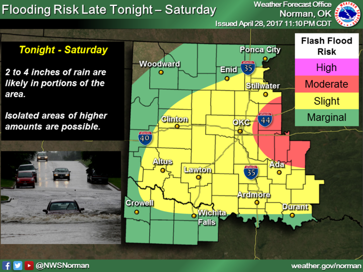
There are several AREAL Flood Advisories going on and even one that covers the southeast portion of Garfield County until 0630 local time due to a lot of rainfall. Training storms will be an issue as the day wears on. Several flood warnings in effect to our south and southwest so if you plan on traveling, check road conditions along your route.
All that said, expect periods of heavy rainfall today as all this mess slowly moves east. The severe threat for us will be low but keep in mind that we can still receive very heavy weather even though the risk isn’t high.
Here is your forecast from the NWS/NORMAN;
Saturday-Showers and possibly a thunderstorm. High near 53. Windy, with a north northeast wind 20 to 25 mph decreasing to 13 to 18 mph in the afternoon. Winds could gust as high as 36 mph. Chance of precipitation is 80%. New rainfall amounts between a quarter and half of an inch possible.
Saturday Night-Chance of showers and thunderstorms, then showers likely after 1am. Cloudy, with a low around 39. North northwest wind 13 to 15 mph, with gusts as high as 21 mph. Chance of precipitation is 60%. New rainfall amounts between a tenth and quarter of an inch, except higher amounts possible in thunderstorms.
Have a good day and stay dry!!
MIKE