FROM GARFIELD COUNTY EMERGENCY MANAGEMENT
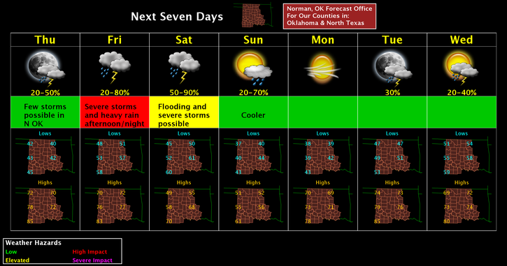
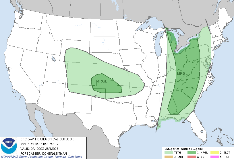
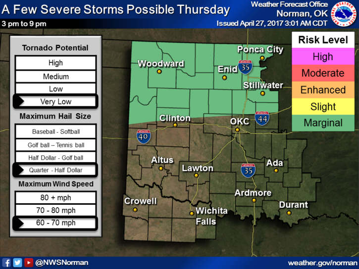
We are in a MARGINAL RISK area for showers and thunderstorms later today. A few could be severe with wind and hail being the main threats. Depending how this actually sets up, we could be looking a squall line situation as this wave moves through later today and tonight. As most are aware, bowing segments on a line of thunderstorms can put out very strong and possibly severe winds. We’ll keep an eye out for this as storms develop and move through the area.
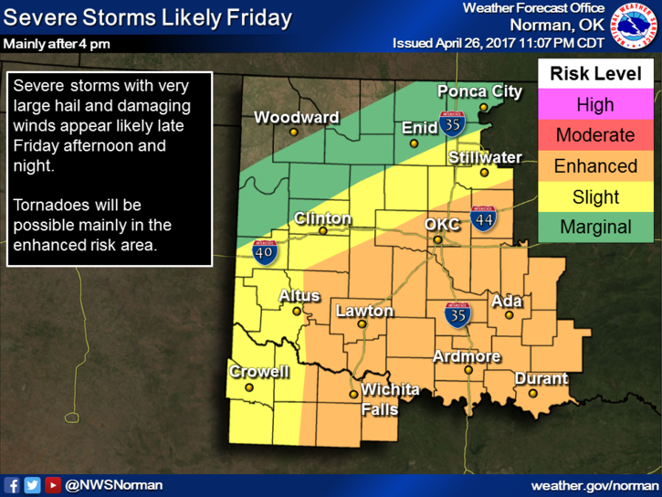
The next issue in the forecast discussions is tomorrow. We will be generally in a SLIGHT RISK area and could get upwards of ½ to 1.5 inches of rain. Again that is a possibility. As I stated yesterday, traveling south, southeast, or east on FRIDAY isn’t a good idea. If you just have to go, stay extremely weather aware as you travel. The forecast will modify a few times concerning tomorrow so stay up with the latest from the NWS OFFICE in the area you plan on traveling. All offices in the region can be found here: https://gcem.org/links/
It would be a good idea to get our app downloaded and learn how it works before storms arrive. There are many features in this app that will work for you in any area you may be traveling. The app is named GARFIELD COUNTY EM.
Here is your forecast from the NWS/NORMAN;
Thursday-Partly sunny, with a high near 70. South southeast wind 7 to 12 mph increasing to 17 to 22 mph in the afternoon. Winds could gust as high as 31 mph.
Thursday Night-40 percent chance of showers and thunderstorms before 1am. Mostly cloudy, with a low around 50. Southeast wind 8 to 16 mph becoming west northwest after midnight. Winds could gust as high as 23 mph.
HAVE A SUPER DAY!!
MIKE