0410L-FRIDAY OUTLOOK FROM GARFIELD COUNTY EMERGENCY MANAGEMENT-8/14/2020
1- GENERAL thunderstorm risk again today. Not going to hold my breath on any precip during the day but as a wave comes into Northwest and Western Kansas later today, we could possibly see some rain overnight depending on the storm track. We’ll see what happens for sure as forecasts verify or not.
2- Today should be our last hot day for a while as a front will push in and cause our high temps to fall into the mid to upper 80’s for the next week or so. Our rain chances will increase some since we will be under NW flow. It should be interesting!!
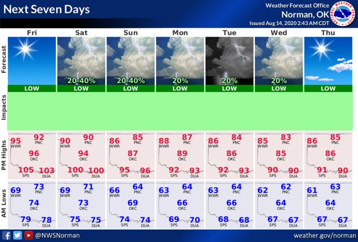
3- Here is your forecast from the NWS/NORMAN;
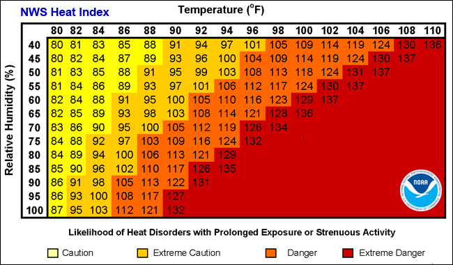
Friday- Sunny with a high near 93. Heat index values as high as 103. East winds 5 to 10 mph.
Friday Night-Partly cloudy with a low around 71. East winds around 10 mph.
HAVE A GOOD DAY!!
MIKE