0355L-SATURDAY OUTLOOK FROM GARFIELD COUNTY EMERGENCY MANAGEMENT-8/15/2020
1-GENERAL RISK again today for thunderstorms. Our chances are better later this evening & overnight. Otherwise, hot with a heat index of around 101.
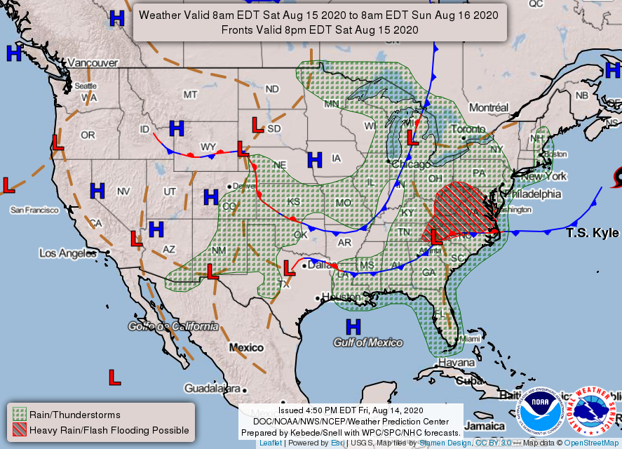
2- Thunderstorms in our area could occur very early Sunday morning. A few may be severe. I’ll keep an eye out on the guidance for this and advise as needed. Make sure you have our GARFIELD COUNTY EM app.
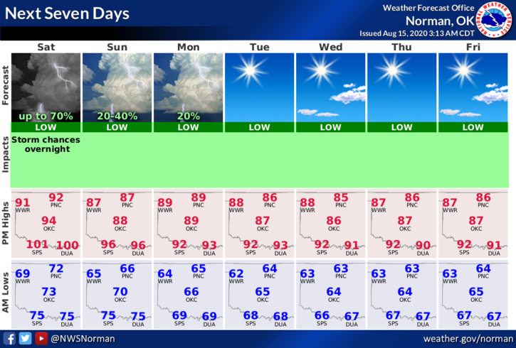
3- Here is your forecast from the NWS/NORMAN;
Saturday-Mostly sunny with a high near 92. Heat index values as high as 101. Northeast wind 5 to 10 mph.
Saturday Night-50 percent chance of showers and thunderstorms mainly after midnight. Increasing clouds with lows in the mid to upper 60s. East wind around 10 mph.
HAVE A GOOD DAY!!
MIKE