FROM GARFIELD COUNTY EMERGENCY MANAGEMENT-FRIDAY 8/18/17
Download our emergency app-GARFIELD COUNTY EM. IT JUST MIGHT SAVE YOUR LIFE!
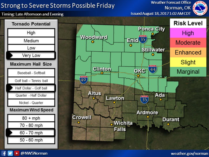
We are in a MARGINAL RISK AREA for severe weather later today. Timing appears to be late this afternoon into the evening hours. As I type this morning at 4 am, there are some thunderstorms that may give us a few showers a bit later on. These are being watched carefully. Some of these are pretty stout and could be severe due to winds and hail.
Just be prepared for some noise, flashes of light, water and possibly hard water falling from the sky. Figured I would give a different perspective this morning. Keeps you all on your toes. 🙂 We’ll be ok but just stay weather aware as the day progresses.
That said, here is your forecast from the NWS/NORMAN;
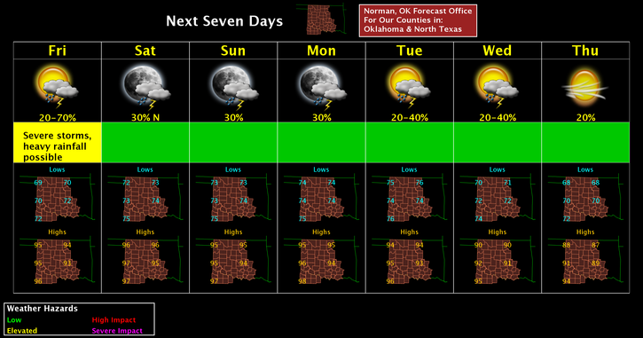
Friday-50 percent chance of showers and thunderstorms, mainly before 1pm. Partly sunny, with a high near 95. South southwest wind 6 to 11 mph. New rainfall amounts between a tenth and quarter of an inch, except higher amounts possible in thunderstorms.
Friday Night-20 percent chance of showers and thunderstorms. Partly cloudy with a low around 74. South wind 5 to 11 mph.
Have a great day and I’ll advise as conditions warrant.
MIKE