FROM GARFIELD COUNTY EMERGENCY MANAGEMENT-THURSDAY 8/17/17
Storms pushed through the area between 6:30 and 8pm last night and we did suffer some wind damage. Power poles were broken in various areas due to the wind gusts. Trees were also affected. I had asked last night that if anyone was affected by damage of any kind to let me know. I did receive several reports through the GARFIELD COUNTY EM app and a few through email. Thank you for those reports. Others will follow but please report all your damage.
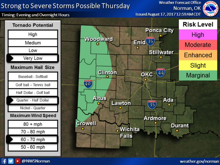
We may see another round late tonight as another system comes rolling off the high plains. The severe threat will be mostly out west as the attached graph shows. Just keep in mind, once again, that graphs will change as the forecast changes and verifies. IF STORMS DO OCCUR, they will happen during the overnight hours and winds will be the primary threat.
Here is your forecast for today and tonight from the NWS/NORMAN;
Thursday-Sunny, with a high near 91. North wind 5 to 7 mph becoming light and variable in the afternoon.
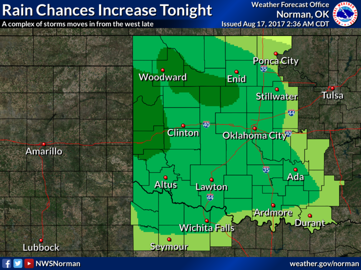
Thursday Night-Showers and thunderstorms likely after 1am. Increasing clouds, with a low around 70. East southeast wind 6 to 11 mph becoming southwest after midnight. Chance of precipitation is 60%. New rainfall amounts of less than a tenth of an inch, except higher amounts possible in thunderstorms.
HAVE A SUPER DAY!!
MIKE