0320L-FRIDAY OUTLOOK FROM GARFIELD COUNTY EMERGENCY MANAGEMENT-8/18/23
*HEAT ADVISORY IN EFFECT FROM 1PM UNTIL 9PM ON SATURDAY.
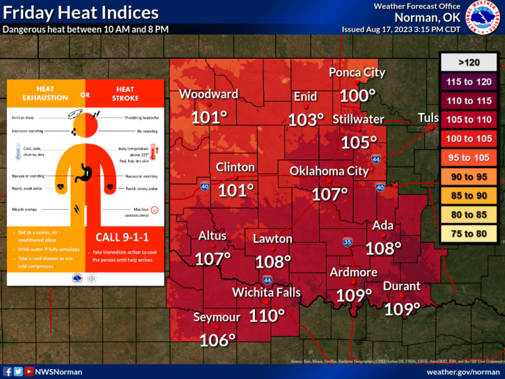
*The front that pushed through yesterday will retreat back to the north as a warm front during the day and bring southerly winds and the heat back with it. Our HEAT INDEX, after this occurs, will possibly get up to around 103 this afternoon. It will be a little toasty later today. Over the weekend, actual temps will be in the low 100’s. Just remember that it’s summer and heat happens.
* Here is your forecast from the NWS/NORMAN;
Today-Sunny. Highs in the upper 90s. East winds around 10 mph.
Tonight-Mostly clear. Lows in the mid-70s. Southeast winds 5 to 10 mph.
*Call in controlled burns to dispatch and they’ll let us know what’s going on. That number is 580-234-(FIRE)-3473.
*If you see smoke or fire, call 9-1-1 immediately so the proper response can be sent.
*Download our GARFIELD COUNTY EM app and click on the GCEM Blog icon. You will find my daily posts there AND on the front page of our website at https://gcem.org
HAVE A GOOD DAY!