0400L-FRIDAY OUTLOOK & INFO FROM GARFIELD COUNTY EMERGENCY MGMT-12/13/19
1- First of all, GARFIELD COUNTY EM is our notification app. Make sure you have it and keep up with the latest advisories and or warnings from us and the NWS.
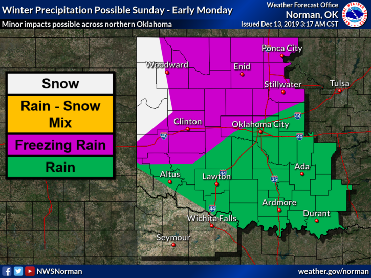
2- It appears that we are possibly looking at a light freezing rain/snow event here in our area. As it looks right now actual storm track should be across central Kansas. This will continue to change some until it gets closer. Either way, if you plan on traveling, make sure you stay weather aware from home to destination and back. The worst weather looks like it will occur Sunday afternoon into the overnight hours into Monday. We’ll see how this mess actually comes together.
3- Unlike some TV folks, there is NO REASON TO PANIC. The forecast will change several times between now and then so just stay weather aware, as stated above, and you’ll be ok. We’ll stay on top of this and advise accordingly. Until any precip actually occurs, if you see smoke or fire, call 911 immediately.
4- Here is your countywide forecast from the NWS/NORMAN;
Today-Partly cloudy. Highs in the upper 50s. Light and variable winds.
Tonight-Mostly clear. Lows in the lower 30s. Light and variable winds becoming northwest around 10 mph after midnight.
HAVE A SUPER DAY!!
MIKE