0345L-THURSDAY OUTLOOK & INFO FROM GARFIELD COUNTY EMERGENCY MGMT-12/12/19
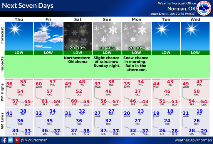
1- The big news as of right now is MAYBE we’ll see some snow or a winter mix. Models are not in total agreement and the path appears to be farther north than previous model runs. This will change! There are many “ifs” right now but here in northern Oklahoma, we stand a better chance of seeing some winter precip either way. We’ll have to wait and see as the system gets closer and hopefully the models come closer to agreement.
2- That said we’ll stay fairly warm until Friday night when a front pushes through bringing a slight cool-off. The Sunday afternoon/evening front is where the colder air will push in bringing some winter precip.
3- Personally, based on all the guidance I’ve read this morning, it can go either way at this point. I would at least make sure you are prepared. If it does snow, it won’t be a crippling event. I am more concerned about an ice event but even that is one of those ifs.
4- Overall, we’ll be ok so here is your forecast from the NWS/NORMAN;
Thursday-Sunny with a high near 54. South winds 5 to 15 mph gusting as high as 25 mph.
Thursday Night-Mostly cloudy with a low around 33. South winds around 5 mph.
Note, graphics weren’t updated by the NWS at the time of this post.
HAVE A SUPER DAY!!
MIKE