0405L-SATURDAY OUTLOOK & INFO FROM GARFIELD COUNTY EMERGENCY MGMT-12/14/19
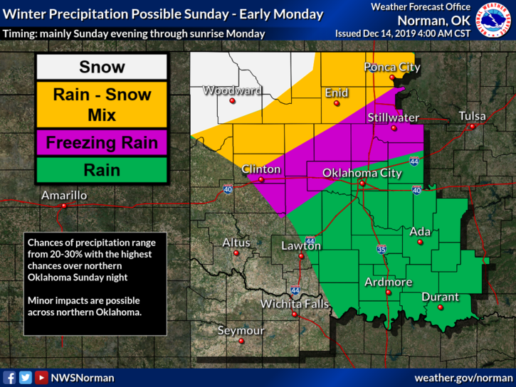
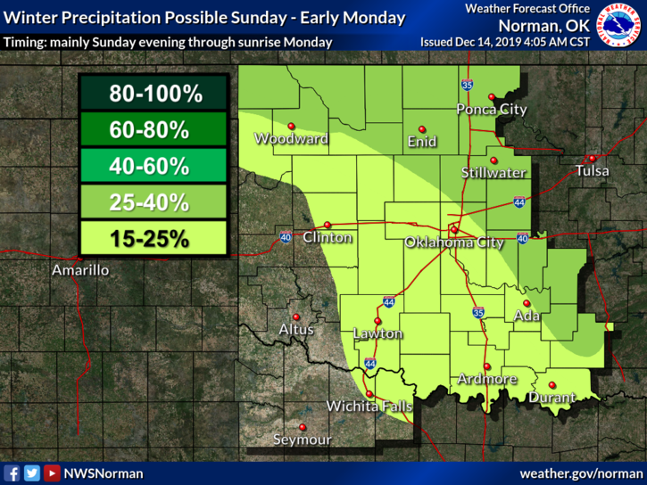
1- A weak cold front has pushed through the area overnight. Today’s temps will be a little cooler than yesterdays. Precipitation isn’t expected until the main system starts to affect us on Sunday in which colder air will push in along with a slight chance for freezing rain/drizzle. The heavy snow looks to occur through central and northern Kansas. Models are still not in agreement and impacts for this storm look to be weaker FOR US.
2- No need to panic or be upset. If you all will recall this past fall, the panic started 5-10 days out when other storm systems are overseas and then it’s hyped a lot and then nothing extremely bad happened. When it’s stated that models are not in agreement, just make sure you are prepared in the event things do change.
3- Timing of storm systems, the track of the systems, and then what the storm systems ACTUALLY do, are 3 major factors. WE WILL SEE, MOST LIKELY, SOME FREZZING DRIZZLE/RAIN. Anything else at least at the time of this post will depend on what the storm system ACTUALLY does. Stay up with the latest info from your local NWS OFFICE. You can find them all here- https://gcem.org/links/
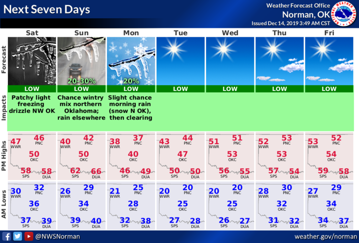
4- Here is your forecast for Saturday from the NWS/NORMAN;
Today-Partly cloudy and cooler with highs in the upper 40s. North winds around 10 mph in the morning becoming light and variable.
Tonight-Partly cloudy with patchy drizzle and light freezing drizzle after midnight. Lows in the upper 20s. East winds around 10 mph.
As stated, we’ll keep an eye on the situation and you can too at the above link. HAVE A GOOD DAY!
MIKE