0410L-FROM GARFIELD COUNTY EMERGENCY MANAGEMENT-FRIDAY-12/8/17
Today’s info in line item form:
BITTER COLD this morning with wind chill temps from 3-10 degrees.
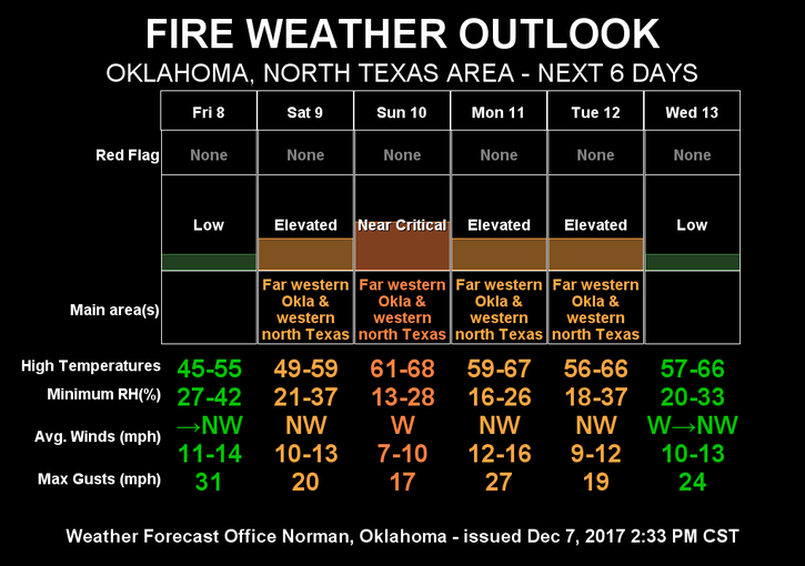
FIRE DANGER is LOW today but be extremely careful. It won’t take much to start a fire.
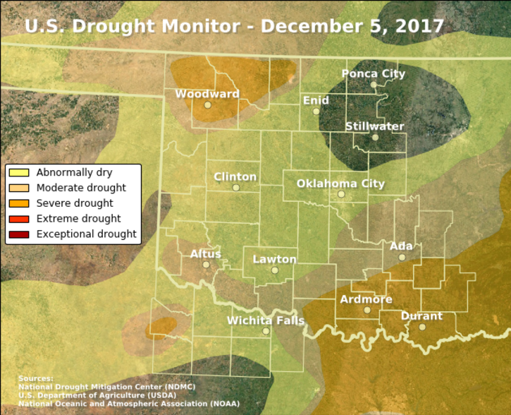
The DROUGHT MONITOR has us in an abnormally dry area. It will become worse.
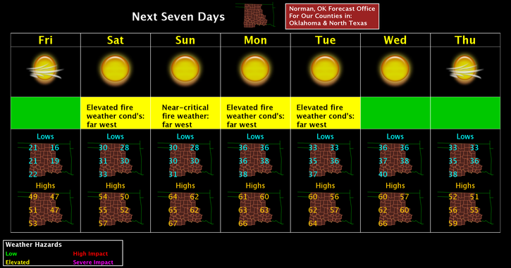
Forecast wise for the next week or so: Highs ranging from the upper 40’s to upper 50’s.
Low temps will average in the low to mid 30’s. Several fronts will occur but will be dry.
Your forecast from the NWS/NORMAN FOR TODAY:
Friday-Partly sunny, then gradually becoming sunny, with a high near 48. South southwest wind 7 to 11 mph becoming north northwest in the afternoon.
Friday Night-Mostly clear with a low around 28. West northwest wind 6 to 10 mph.
HAVE A SUPER DAY!!
MIKE