FRIDAY OUTLOOK & INFO FROM ENID/GARFIELD COUNTY EMERGENCY MANAGEMENT-2/15/19
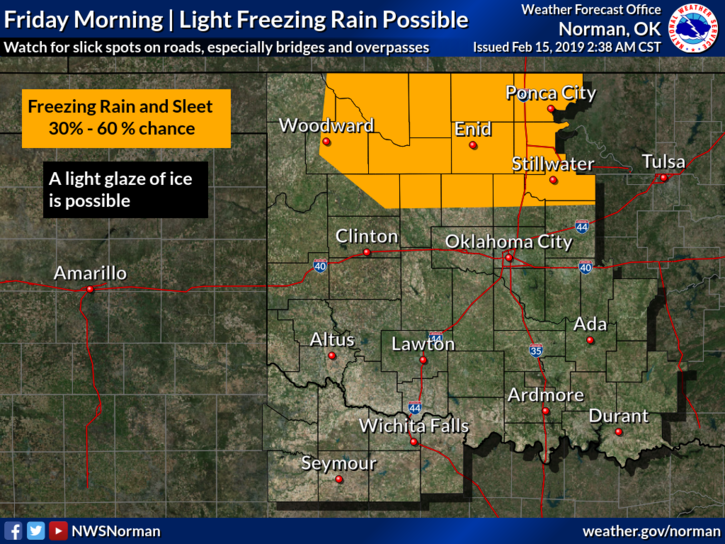
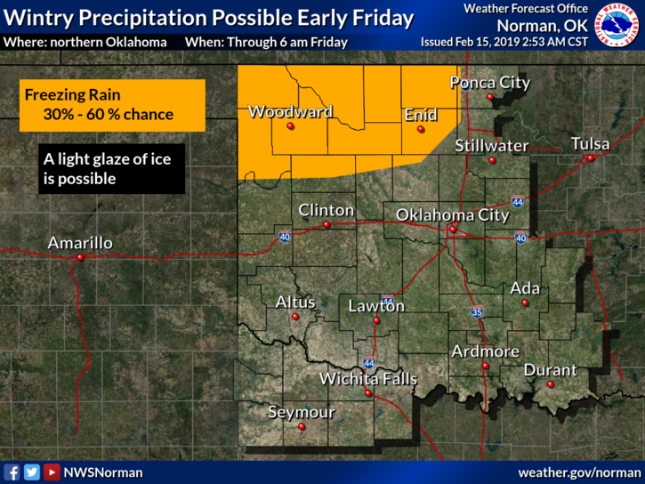
WINTER WEATHER ADVISORY HAS BEEN “EXTENDED” UNTIL NOON TODAY.
1) Light precip is occurring off and on early this morning. When getting out today, drive slowly and remember that elevated surfaces like bridges and overpasses COULD be affected. Current Road Conditions from ODOT and all states surrounding Oklahoma are on the front page of our website- www.gcem.org
2) No need to freak out, we’ll live through this one too. There is a possibility that we may see actual snow on Tuesday so there is hope!!
3) Overall, we’ll be ok. For those that wear a heavy coat and shorts then complain it’s cold, I have this statement for you; WEAR PANTS!!
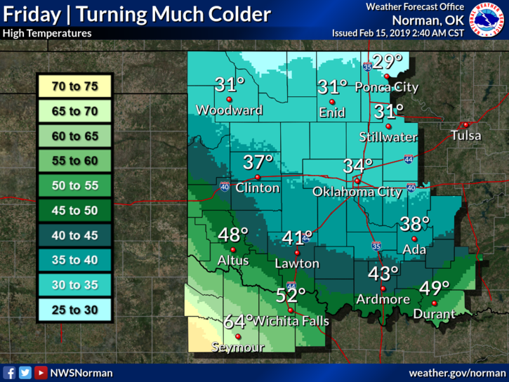
4) Here is your forecast from the NWS/NORMAN;
Friday- Freezing rain likely, mainly before 9am. Cloudy with a high near 31. Northeast winds 10 to 15 mph with gusts as high as 20 mph. Chance of precipitation is 60%. New ice accumulation of less than a 0.1 of an inch possible.
Friday Night-Mostly cloudy with a low around 22. Northeast winds around 10 mph.
I will send updates out today, as needed, over our GARFIELD COUNTY EM app.
HAVE A SAFE AND SUPER DAY!!
MIKE