0358L-THURSDAY OUTLOOK FROM GARFIELD COUNTY EMERGENCY MANAGEMENT-2/14/19
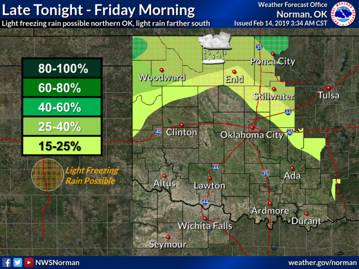
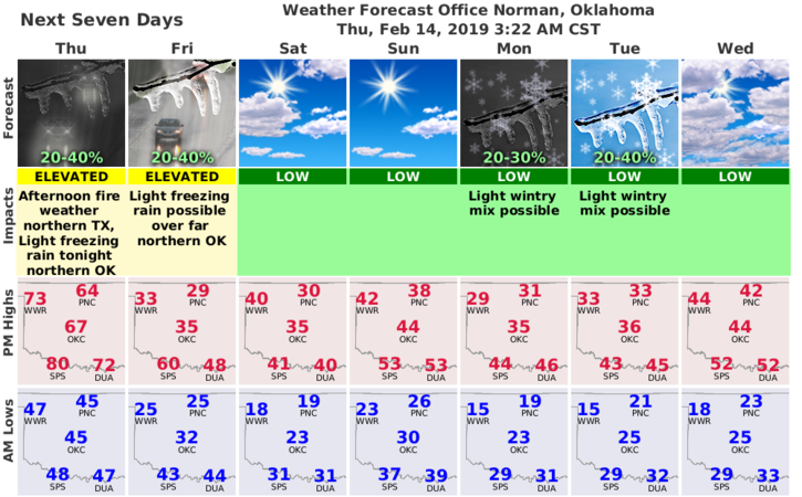
1) ENJOY TODAY!! Several fronts will affect the area over the next 3-5 days. The first will come through this afternoon. The cold air will come in later this evening bringing with it a chance for freezing drizzle/rain overnight into Friday. That chance is 20% right now.
2) REMEMBER, the above could change during the day so I’ll send updates out over our GARFIELD COUNTY EM app as needed during the day.
3) On the additional fronts, models are NOT totally in agreement other than we will be cold for the next week or so. Timing, precip type, and exact locations are not nailed down yet either. YES, we will be affected by some sort of winter precip over the next week or so but as these systems get closer, guidance should verify.
4) Here is your forecast from the NWS/NORMAN;
Thursday- Mostly sunny with a high near 65. Southwest wind 8 to 14 mph becoming north northeast in the afternoon. Winds could gust as high as 20 mph.
Thursday Night-20 percent chance of rain after midnight. Mostly cloudy with a low around 27. Northeast wind 9 to 16 mph with gusts as high as 23 mph.
HAVE A GOOD DAY!!
MIKE