0405L-FRIDAY UPDATE FROM GARFIELD COUNTY EMERGENCY MANAGEMENT-2/23/18
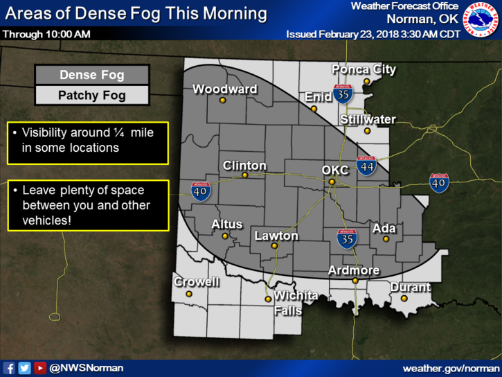
WHAT A WEEK AND WATCH OUT FOR PATCHY FREEZING FOG THIS MORNING. It may not look slick out there but it is.
1- High temps are expected to reach the low to mid 40’s today but early this morning the fog may present some new sliding around issues. If driving this a.m., use EXTREME CAUTION.
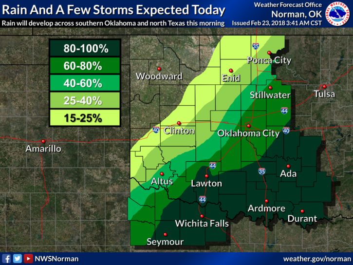
2- Rain chances return tonight and during the morning on Saturday. We should remain above freezing so it will be all liquid.
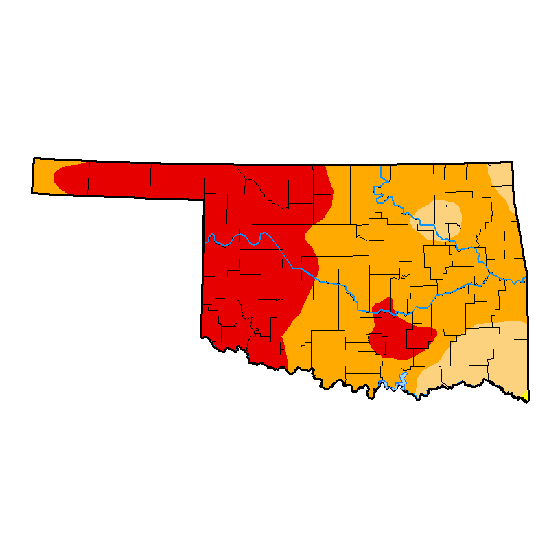
3-The new drought monitor is out and hasn’t changed too much. It looks like it may change a little next week. For now, we are still split between a severe and extreme drought conditions. The BURN BAN is still in effect so please NO BURNING OUT THERE.
4- Overall, we made it through the week and we will see some sunshine over the weekend and MAYBE some today. We’ll see on that one.
5- Here is your forecast from the NWS/NORMAN;
Friday-Patchy freezing fog before 9am. Partly sunny with highs near 43. Calm wind becoming northeast 5 to 10 mph this morning.
Friday Night-A chance of showers and thunderstorms before midnight, then a chance of rain after midnight. Cloudy, with a low around 38. East northeast wind around 10 mph. Chance of precipitation is 40%.
FINALLY, DRIVE CAREFULLY and watch out in the foggy areas early this morning. HAVE A GREAT DAY!!
MIKE