0340L-FRIDAY OUTLOOK & INFO FROM GARFIELD COUNTY EMERGENCY MANAGEMENT-2/7/2020
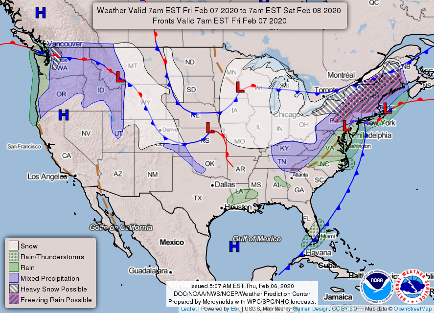
1-We have a weak surface trough that will move through the area shifting winds to the northwest during the day. No dramatic changes with this other than a windshift. We are under NW flow atmospherically so these little troughs will affect us off and on. We do expect rainfall around the area Sunday but I wouldn’t hold my breath just yet. Rain and light snow could be possible as another storm system starts to affect the area early next week.
2- Overall, we’ll be ok so get outside and enjoy the sunshine, out of the wind. It should feel good. Northerly winds should lie down later tonight.
3- We have our website https://gcem.org which is loaded with preparedness info along with weather information. Our GARFIELD COUNTY EM app is the same way. Take some time to first download our app and learn how it works, then go to our website and explore it so when things go crazy this Spring, you’ll know where to go for up to date info. This is why I continue to state PREPAREDNESS=RESILIENCE. If YOU are NOT prepared, it YOU’RE fault.
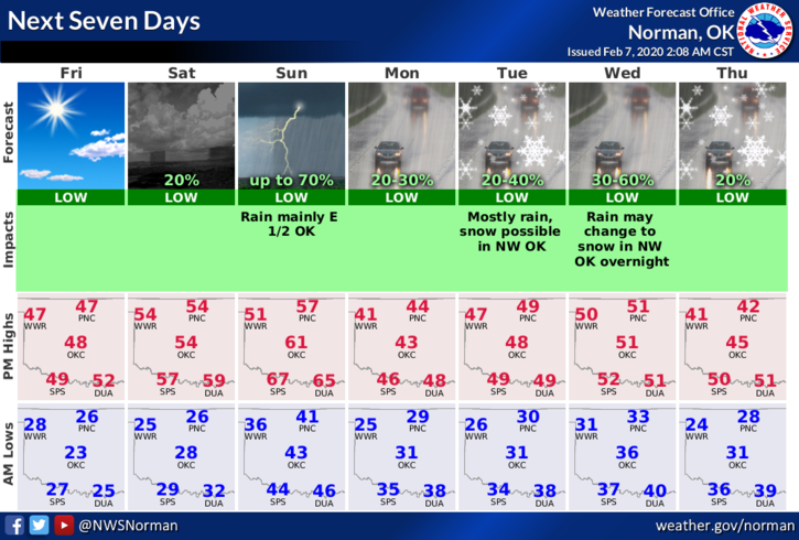
4- Here is your forecast from the NWS/NORMAN;
Today-Partly cloudy with highs in the upper 40s. Northwest winds 10 to 15 gusting to 20 mph.
Tonight-Mostly cloudy with lows in the mid-20s. Light and variable winds.
HAVE A SUPER DAY!!
MIKE