0415L-FRIDAY OUTLOOK FROM GARFIELD COUNTY EMERGENCY MANAGEMENT-1/25/19
1) You may see some snow flurries again today but there shouldn’t be any accumulation per guidance. As stated earlier this week, we are under NORTHWEST FLOW right now so we can expect temps to be up and down and variations of light precip as these troughs move through the area.
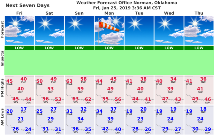
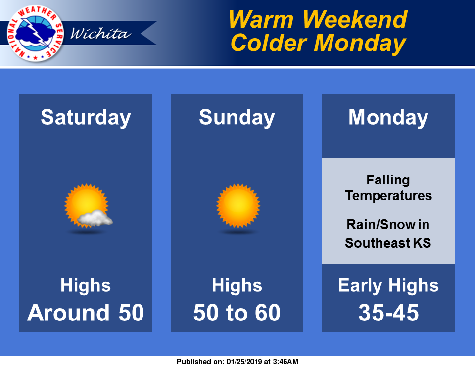
2) We will warm up this weekend with Sunday being the warmest day then we cool back down again. Oh well, it’s winter. If we actually get an influx of moisture, precip amounts might change some. We’ll just have to wait and see.
3) Overall, we’ll be ok. Just keep a coat in the car, truck, or whatever.
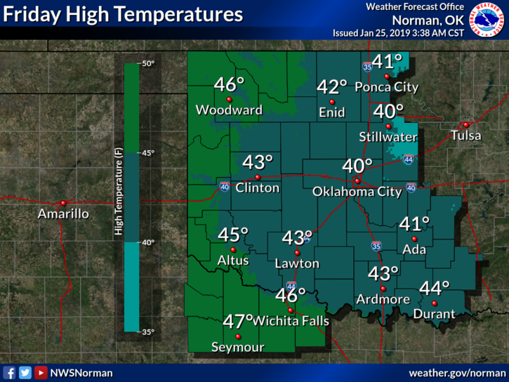
4) Here is your forecast from the NWS/NORMAN;
Friday-Slight chance of flurries between 9am and 3pm. Cloudy through mid morning, then gradual clearing, with a high near 42. Southwest wind 6 to 14 mph, with gusts as high as 22 mph.
Friday Night-Mostly clear, with a low around 28. Southwest wind around 6 mph.
HAVE A GOOD DAY!!
MIKE