0325L-FRIDAY OUTLOOK FROM GARFIELD COUNTY EMERGENCY MANAGEMENT-1/07/22
1- We have been placed in an EXTREME DROUGHT. The FIRE DANGER will continue through the winter. Use extreme caution if a controlled burn is necessary. There is no BURN BAN at this time for Garfield County. Please abide by Forestry guidelines before starting any controlled burn. Here is a link for very good info- https://forestry.ok.gov/sites/g/files/gmc801/f/burn_within_the_law_5.26.21_3.pdf
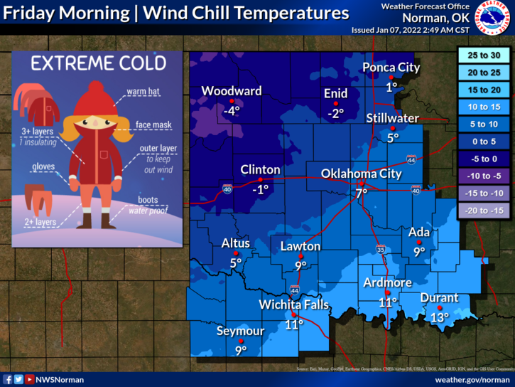
2- We will recover to above freezing temps roughly around noon to 1400 local time. We’ll be the 30s but that’s better than the upper teens to low 20s. We should see temps into the upper 50s over the weekend. We’ll see what happens.
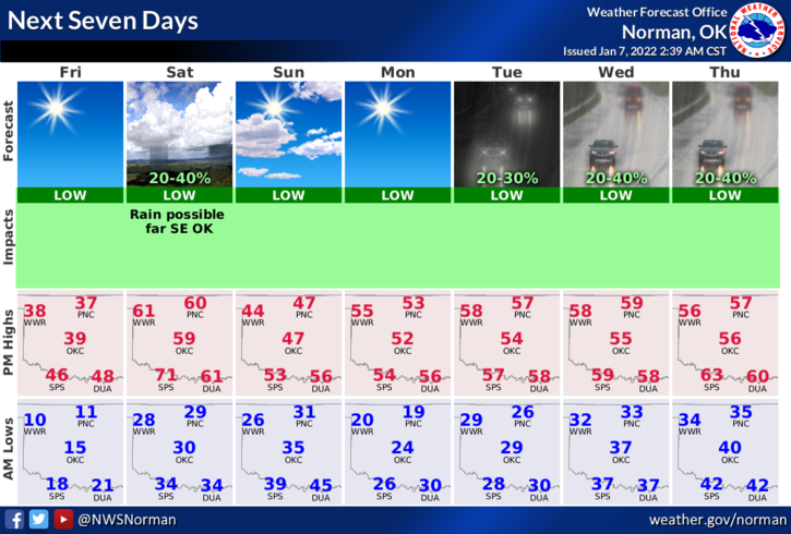
3- Overall, we’ll continue on the roller coaster but hopefully with not so extreme changes in temps. Here is your forecast from the NWS/NORMAN;
Today-Mostly sunny. Not as cold. Highs in the upper 30s. Southeast winds 10 to 20 mph gusting to around 30 mph.
Tonight-Clear. Not as cold. Lows in the mid-20s. South winds 10 to 15 mph gusting to 25 mph.
STAY WARM AND SAFE.