0330L-FRIDAY OUTLOOK FROM GARFIELD COUNTY EMERGENCY MANAGEMENT-7/19/19
HEAT ADVISORY IN EFFECT FROM 11AM UNTIL 8PM THIS EVENING.
GARFIELD COUNTY EM-This is our notification app. If you don’t have it, you are not prepared.
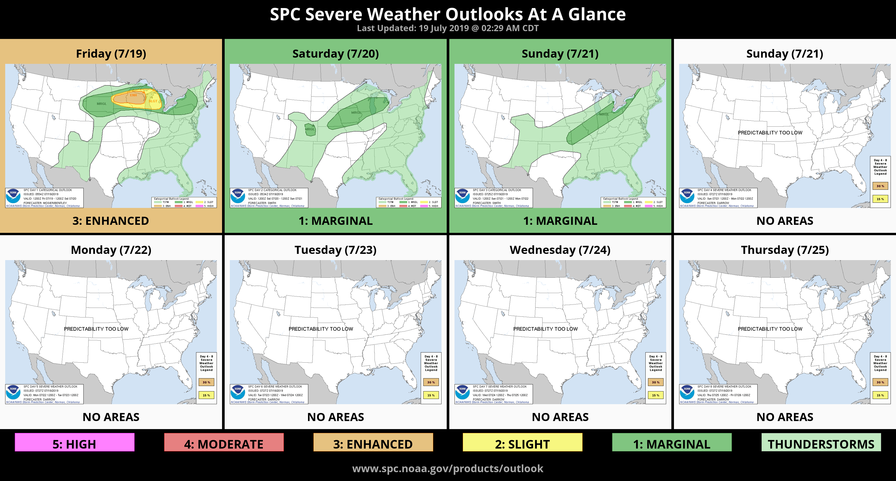
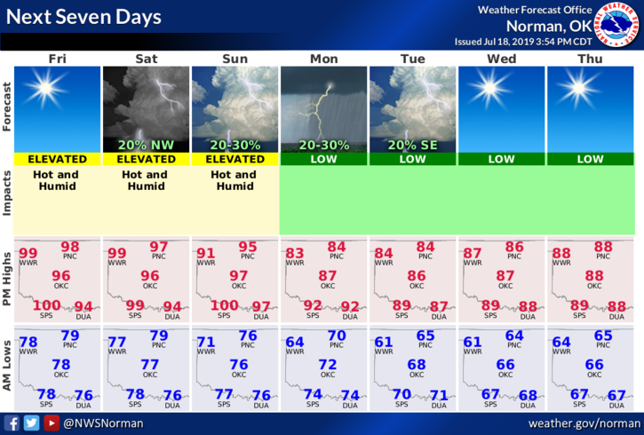
1- High pressure will continue for the next several days giving us HOT temperatures. Our saving grace right now is the wind. Remember those days without wind and it seemed oppressively hot? It’s still going to be hot but the effect is lessened thanks to the wind.
2- We are expecting a cold front later Sunday into Monday which gives us a chance for RAIN. The chance is low but we’ll see what happens. Temps will drop after the front comes through.
3- Overall, just pace yourself while working outdoors, stay hydrated, and stay cool as much as possible. Welcome to summer!!
4-Here is your forecast from the NWS/NORMAN;
Today- Sunny and hot with a high near 100. Heat index values as high as 104. South winds 15 to 25 mph with higher gusts.
Tonight- Clear with a low around 78. South winds 15 to 25 mph.
Have a good day!!
Mike