0255L-FRIDAY OUTLOOK FROM GARFIELD COUNTY EMERGENCY MANAGEMENT-7/21/23
*SEVERE THUNDERSTORM WATCH UNTIL 0700 LOCAL TIME THIS MORNING.
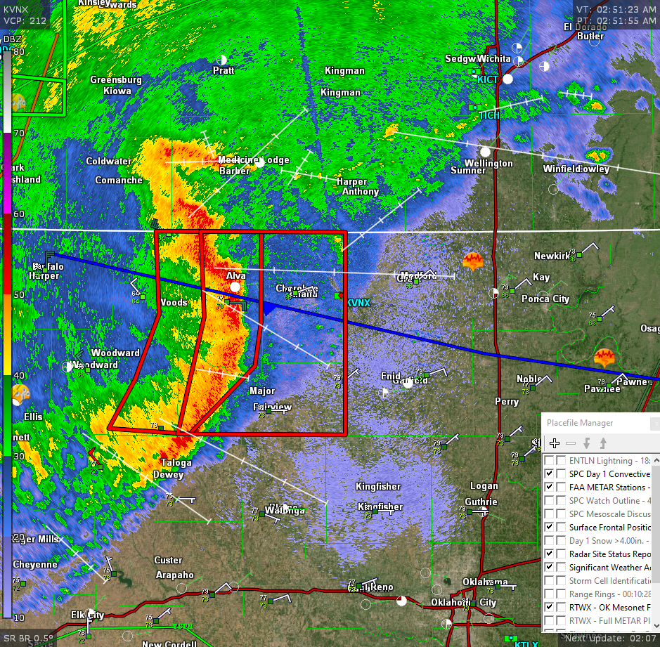
*At 0245 local time we have a line of t-storms moving our way, see graphic. By the time most folks see the graphic the storms will be on us or just past us. The main threats with this will be wind gusts upwards of 70 mph and torrential rainfall. This line is moving east at roughly 45 mph so if we see those higher gusts, it will be with the leading edge of the line. Other than that, we can look forward to cooler temps for the next few days and lower humidity. Hopefully we won’t need lifeboats with the torrential rainfall.
*Overall, we’ll be ok so here is your forecast from the NWS/NORMAN;
Today-Mostly cloudy with showers and thunderstorms likely this morning, then partly sunny this afternoon. Highs around 80. Northeast winds 10 to 15 mph. Chance of rain 70 percent.
Tonight-Partly cloudy in the evening, then becoming mostly clear. Lows in the lower 60s. Northeast winds 5 to 10 mph, becoming northwest after midnight.
*Download our GARFIELD COUNTY EM app. Preparedness and Knowledge gives you that edge in knowing what to do on protecting yourself and your family.
HAVE A GOOD DAY!