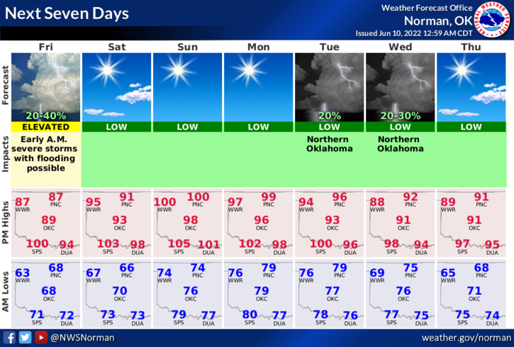
0320L-FRIDAY OUTLOOK FROM GARFIELD COUNTY EMERGENCY MANAGEMENT-6/10/22
1- SEVERE THUNDERSTORM WATCH until 0800 AND A FLOOD WATCH until 0700 this morning. There is a slight chance we could see some thunderstorm activity out of southern Kansas this morning. If storms do occur, strong winds will be our initial threat followed by heavy rainfall and possibly some hail. We’re keeping an eye out for this.
2- After this mess clears the area, expect temps to rise. We may see high temps in the upper 90s to low 100’s this weekend along with very uncomfortable humidity which will increase the heat index. Use extreme caution this weekend while working outdoors.
3- Here is your forecast from the NWS/NORMAN;
Friday-10 percent chance of showers and thunderstorms before 7am. Some of the storms could be severe. Mostly sunny, with a high near 88. South wind 6 to 10 mph becoming west northwest in the afternoon.
Friday Night-Partly cloudy, with a low around 67. East northeast wind around 8 mph.
HAVE A GOOD DAY!