0325L-THURSDAY OUTLOOK FROM GARFIELD COUNTY EMERGENCY MANAGEMENT-6/9/22
1- Here is your forecast from the NWS/NORMAN;
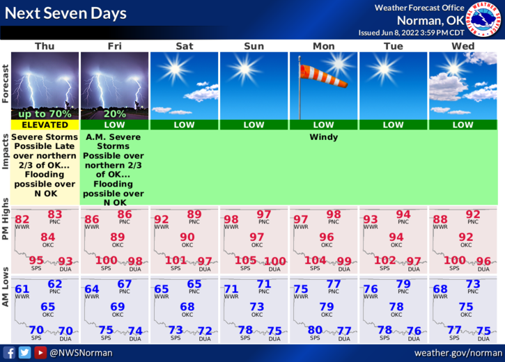
Thursday-Mostly sunny, with a high near 83. East northeast wind 5 to 10 mph becoming south in the afternoon.
Thursday Night-Showers and thunderstorms likely, mainly between 1am and 4am. Some of the storms could be severe. Increasing clouds, with a low around 67. Southeast wind 5 to 15 mph, with gusts as high as 20 mph. Chance of precipitation is 60%. New rainfall amounts between a tenth and quarter of an inch, except higher amounts possible in thunderstorms.
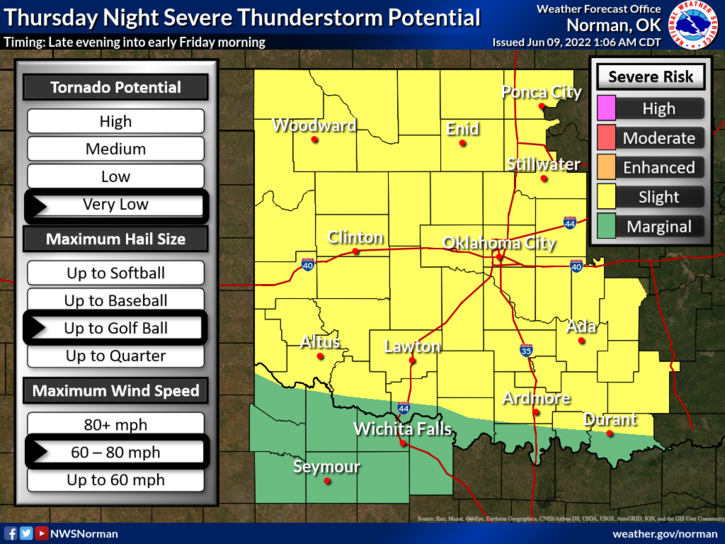
2- SLIGHT RISK for severe weather later this evening and overnight. “IF” storms occur, expect hail up to golf ball size and wind gusts upwards of 60-80 mph. The tornado threat is very low at the time of this outlook.
3- SO, we have 1 more day and night to deal with a possibility of severe weather and then the HEAT sets in. Highs will average in the 90s and overnight lows will be in the 70s. With all of the rainfall don’t forget about the HEAT INDEX. It may feel like the mid-90s but the heat index could be in the 100’s. Use extreme caution while working outdoors. Watch out for the SKEETERS too!
4- Overall, we’ll be ok. HAVE A GOOD DAY!