0400L-FRIDAY OUTLOOK & INFO FROM GARFIELD COUNTY EMERGENCY MGMT-6/12/2020
1-Scattered showers will be around this morning but we’ll recover from these by afternoon. These have been triggered by a low level jet associated with a trough moving through the area. These storms are producing some lightning and light rain. Temps are expected to climb back up into the 90s and the fire danger will increase once again.
2- FIRE CREWS from many Garfield County departments have been fighting fires in eastern Major County over the last several days. You have probably seen the smoke plums out west. PLEASE do not drive out into those areas as fire crews need those roads to re-fill with water as they work to put out fires. They are driving quickly back and forth and we don’t need any accidents. We appreciate your cooperation on this.
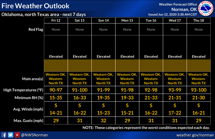
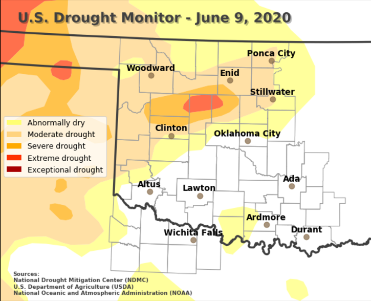
3- Even though we are in both a Moderate and Severe drought area, we have been lucky here in Garfield County that we haven’t had anything major during this same timeframe. Dewpoint temps in the mid-40s and relative humidity in the low 20s will spark another day of fires so please stay aware of emergency vehicles out there. Here and around the county, if you see smoke or fire call 911. We appreciate it.
4- Here is your forecast from the NWS/NORMAN;
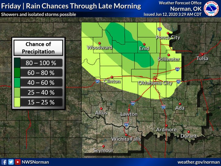
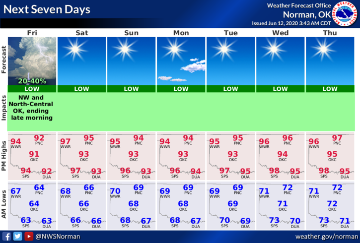
Friday-20% chance of showers and thunderstorms before 10am, then sunny with a high near 95. South winds 10 to 15 mph with gusts as high as 21 mph.
Friday Night-Mostly clear with a low around 66. South wind 5 to 10 mph.
Have a good day!
MIKE